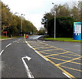
IMAGES TAKEN NEAR TO
Pencoed Technology Park, BRIDGEND, CF35 5HZ

Introduction

This page details the photographs taken nearby to Pencoed Technology Park, CF35 5HZ by members of the Geograph project.

The Geograph project started in 2005 with the aim of publishing, organising and preserving representative images for every square kilometre of Great Britain, Ireland and the Isle of Man.

There are currently over 7.5m images from over14,400 individuals and you can help contribute to the project by visiting https://www.geograph.org.uk

Image Map


Images are licensed for reuse under creativecommons.org/licenses/by-sa/2.0
Notes
  • Clicking on the map will re-center to the selected point.
  • The higher the marker number, the further away the image location is from the centre of the postcode.

Image Listing (8 Images Found)

Images are licensed for reuse under creativecommons.org/licenses/by-sa/2.0
Image
Details
Distance
1
TSB Call Centre, Pencoed
Image: © Kev Griffin Taken: 14 Nov 2004
0.21 miles
2
M4 eastbound at Pencoed
Image: © Colin Pyle Taken: 11 Sep 2011
0.23 miles
3
Rhondda Cynon Taf : M4 Motorway
The M4 Motorway heading towards junction 35.
Image: © Lewis Clarke Taken: 10 Apr 2014
0.23 miles
4
Pencoed Technology Park entrance
On the east side of the A473. No unauthorised access beyond the barrier.
Image: © Jaggery Taken: 9 Nov 2014
0.24 miles
5
Rhondda Cynon Taf : M4 Motorway
The M4 Motorway heading eastbound as it passes through the Rhondda Cynon Taf area.
Image: © Lewis Clarke Taken: 11 Apr 2014
0.24 miles
6
Along the grassy central reservation of the A473, Pencoed
Looking SSW from the edge of the roundabout at the Felindre Road junction.
Image: © Jaggery Taken: 9 Nov 2014
0.24 miles
7
10mph speed limit on the road to Pencoed Technology Park
From the A473. The red notice under the speed limit sign shows No unauthorised vehicles allowed beyond this point.
Image: © Jaggery Taken: 9 Nov 2014
0.25 miles
8
M4, J35
Image: © N Chadwick Taken: 25 Aug 2013
0.25 miles