1
End of the 30 zone at the northern edge of Coychurch
The 30mph speed limit on Bryn Road increases to the National Speed Limit.
The south side of Coychurch railway bridge https://www.geograph.org.uk/photo/6689078 is in the background.
Image: © Jaggery
Taken: 27 Nov 2020
0.04 miles
2
Grange Crescent, Coychurch
Viewed across Bryn Road.
Image: © Jaggery
Taken: 27 Nov 2020
0.04 miles
3
Bryn Road railway arch and village boundary sign
Image: © Colin Pyle
Taken: 4 May 2012
0.04 miles
4
Start of the 30 zone at the northern edge of Coychurch
The National Speed Limit on Bryn Road drops to 30mph. Ahead for the centre of the village.
Image: © Jaggery
Taken: 27 Nov 2020
0.04 miles
5
South side of Coychurch railway bridge
The bridge carries the South Wales Main Line over Bryn Road in Coychurch. Headroom shown is 14' 9".
Image: © Jaggery
Taken: 27 Nov 2020
0.04 miles
6
Coychurch railway bridge identifier
On the wall on the left here. https://www.geograph.org.uk/photo/6689078
Image: © Jaggery
Taken: 27 Nov 2020
0.04 miles
7
Public footpath direction sign, Bryn Road, Coychurch
The white arrow on the sign points towards these steps https://www.geograph.org.uk/photo/6689265. The text is also in Welsh.
Image: © Jaggery
Taken: 27 Nov 2020
0.04 miles
8
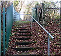
Steps up to a public footpath, Coychurch
Ascending from the west side of Bryn Road.
Image: © Jaggery
Taken: 27 Nov 2020
0.04 miles
9
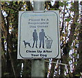
Please Be A Responsible Dog Owner, Bryn Road, Coychurch
The Coychurch Community notice located here https://www.geograph.org.uk/photo/6689272 also shows Clean Up After Your Dog.
Image: © Jaggery
Taken: 27 Nov 2020
0.04 miles
10
North side of Coychurch railway bridge
The bridge carries the South Wales Main Line over Bryn Road in Coychurch. Headroom shown is 14' 9". Ahead for the centre of the village.
Image: © Jaggery
Taken: 27 Nov 2020
0.04 miles


