1
Blue house, Main Road, Coychurch
Located between two pubs - the Prince of Wales and the White Horse (ahead).
Image: © Jaggery
Taken: 23 Nov 2020
0.00 miles
2
Junction of Main Road and Heol-y-capel, Coychurch
Viewed across Main Road. The White Horse pub is on the right.
Image: © Jaggery
Taken: 23 Nov 2020
0.01 miles
3
Churchyard perimeter wall, Coychurch
Stone wall on the east side of Main Road.
The Grade I Listed Parish Church of St Crallo https://www.geograph.org.uk/photo/6700018 is in the background.
Image: © Jaggery
Taken: 23 Nov 2020
0.01 miles
4
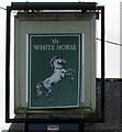
White Horse pub name sign, Coychurch
Facing Main Road on the left here. https://www.geograph.org.uk/photo/6697156
Image: © Jaggery
Taken: 23 Nov 2020
0.02 miles
5
The White Horse, Coychurch
Main Road pub on the corner of Heol-y-capel.
Image: © Jaggery
Taken: 23 Nov 2020
0.02 miles
6
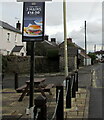
2 mains for ?14 at the White Horse, Main Road, Coychurch
On display on November 23rd 2020, the sign on the right here https://www.geograph.org.uk/photo/6700831 advertises two main meals for £14 Mondays - Fridays until 5pm.
Image: © Jaggery
Taken: 23 Nov 2020
0.02 miles
7
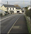
Bend in Main Road, Coychurch
Double white lines indicate no overtaking.
The Parish Church of St Crallo https://www.geograph.org.uk/photo/6700018 is on the right.
Image: © Jaggery
Taken: 23 Nov 2020
0.02 miles
8
Towards a bend in Main Road, Coychurch
The White Horse pub https://www.geograph.org.uk/photo/6700831 is in the background.
Image: © Jaggery
Taken: 23 Nov 2020
0.02 miles
9
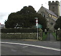
Southwest entrance to the village churchyard, Coychurch
From Main Road near the corner of the road named The Court.
The Parish Church of St Crallo is in the background.
Image: © Jaggery
Taken: 23 Nov 2020
0.02 miles
10
White Horse, Main Road, Coychurch
One of two adjacent village pubs alongside Main Road. The Prince of Wales https://www.geograph.org.uk/photo/6697130 is out of shot on the left.
Image: © Jaggery
Taken: 23 Nov 2020
0.02 miles


