
IMAGES TAKEN NEAR TO
Felindre Road, BRIDGEND, CF35 5BF
Introduction
This page details the photographs taken nearby to Felindre Road, CF35 5BF by members of the Geograph project.
The Geograph project started in 2005 with the aim of publishing, organising and preserving representative images for every square kilometre of Great Britain, Ireland and the Isle of Man.

There are currently over 7.5m images from over14,400 individuals and you can help contribute to the project by visiting https://www.geograph.org.uk
Image Map
Images are licensed for reuse under creativecommons.org/licenses/by-sa/2.0
Notes
- Clicking on the map will re-center to the selected point.
- The higher the marker number, the further away the image location is from the centre of the postcode.
Image Listing (11 Images Found)
Images are licensed for reuse under creativecommons.org/licenses/by-sa/2.0
Image
Details
Distance
1
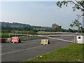
Road closure on the Pencoed Industrial Estate
Only until more capital is invested to further expand industry in the area!
Image: © Mick Lobb
Taken: 21 Sep 2008
0.11 miles
2
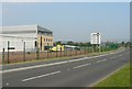
Pencoed Industrial estate
Until recently a quiet rural road but now a highway to an expanding industrial estate.
Image: © Mick Lobb
Taken: 21 Sep 2008
0.13 miles
5
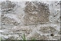
Ordnance Survey Cut Mark
This OS cut mark is one of two which can be found on the barn at Velindre Farm. It marks a point 113.93ft above mean sea level. http://www.geograph.org.uk/photo/5755158
Image: © Adrian Dust
Taken: 28 Apr 2018
0.17 miles
6
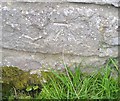
Ordnance Survey Cut Mark
This OS cut mark is one of two which can be found on the barn at Velindre Farm. It marks a point 113.42ft above mean sea level. http://www.geograph.org.uk/photo/5755155
Image: © Adrian Dust
Taken: 28 Apr 2018
0.17 miles
7
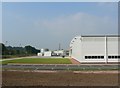
Pencoed Industrial Estate
New industrial estates spring up all along the M4 corridor. Just five years ago this was just another corner of the rural Vale of Glamorgan. The nearby industrial estate, despite many factory closures, continues to expand to eat away at the countryside. The rear of this factory backs onto the M4.
Image: © Mick Lobb
Taken: 21 Sep 2008
0.18 miles
8

Llanilid: postbox № CF35 64
This small postbox serves the Harvester pub/restaurant in the background, the Travelodge hotel behind it, and a few outlying farms and houses. It is emptied finally at 4pm on weekdays and at 9am on Saturdays.
Image: © Chris Downer
Taken: 16 Aug 2010
0.22 miles
9

Llanilid: bilingual postbox information
A close-up of Image, showing the bilingual information which is provided on postboxes in Wales - including the next collection indicator with an abbreviation for Tuesday in both languages.
Image: © Chris Downer
Taken: 16 Aug 2010
0.22 miles
10
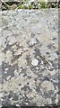
Ordnance Survey Rivet
This OS rivet can be found on the north parapet of the bridge. It marks a point 34.909m above mean sea level.
Image: © Adrian Dust
Taken: 28 Apr 2018
0.22 miles