
IMAGES TAKEN NEAR TO
Worle Avenue, CARDIFF, CF3 4DA
Introduction
This page details the photographs taken nearby to Worle Avenue, CF3 4DA by members of the Geograph project.
The Geograph project started in 2005 with the aim of publishing, organising and preserving representative images for every square kilometre of Great Britain, Ireland and the Isle of Man.

There are currently over 7.5m images from over14,400 individuals and you can help contribute to the project by visiting https://www.geograph.org.uk
Image Map
Images are licensed for reuse under creativecommons.org/licenses/by-sa/2.0
Notes
- Clicking on the map will re-center to the selected point.
- The higher the marker number, the further away the image location is from the centre of the postcode.
Image Listing (9 Images Found)
Images are licensed for reuse under creativecommons.org/licenses/by-sa/2.0
Image
Details
Distance
3
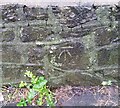
Ordnance Survey Cut Mark
This OS cut mark can be found on the wall SE side of Glastonbury Terrace. It marks a point 37.923m above mean sea level.
Image: © Adrian Dust
Taken: 29 Dec 2021
0.11 miles
5

Grass verge
View across grass verge towards shops in Llanrumney.
Image: © Alan Hughes
Taken: 17 Jan 2018
0.14 miles
6

University Health Board CRT
Community Resource Team, providing health and care support in the community.
Image: © Alan Hughes
Taken: 17 Jan 2018
0.14 miles
7
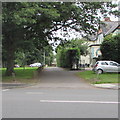
High Croft Walk, Cardiff
From Newport Road along High Croft Walk towards Llanrumney Avenue.
Image: © Jaggery
Taken: 4 Jul 2017
0.23 miles
8
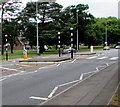
Zebra crossings, Newport Road, Rumney, Cardiff
Two crossings separated by a central refuge.
Image: © Jaggery
Taken: 4 Jul 2017
0.24 miles
9
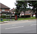
Newport Road bus stop and shelter, Rumney, Cardiff
This side of the road for buses to Newport (bus route 30) and to St Mellons (bus route X45).
Image: © Jaggery
Taken: 4 Jul 2017
0.25 miles