1
Llan Road three-quarters of a mile from Llangynwyd Historic Village
The black arrow on the distance sign points towards this road. https://www.geograph.org.uk/photo/5638118
Image: © Jaggery
Taken: 24 Feb 2017
0.02 miles
2
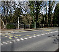
Two telecoms cabinets alongside a Llwydarth Road bus stop, Maesteg
At the southern end of Llwydarth Road, near the corner of Bryn Celyn.
Image: © Jaggery
Taken: 24 Feb 2017
0.02 miles
3
Bryn Celyn, Maesteg
Descending from the corner of Llan Road. Bryn Celyn is unsuitable for heavy goods vehicles.
Image: © Jaggery
Taken: 24 Feb 2017
0.02 miles
4
West along Llan Road towards Llangynwyd Historic Village
The white arrow on the brown sign on the right points the way to Llangynwyd Historic Village.
Image: © Jaggery
Taken: 24 Feb 2017
0.02 miles
5
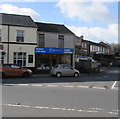
Blinds Express, Maesteg Road, Maesteg
Blinds and curtains shop on the corner of Llan Road, next door to the Cross Inn. http://www.geograph.org.uk/photo/5294768
Image: © Jaggery
Taken: 24 Feb 2017
0.03 miles
6
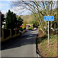
Llan Road towards Llangynwyd Historic Village
The sign on the left shows three-quarters of a mile to Llan(gynwyd Historic Village).
Image: © Jaggery
Taken: 24 Feb 2017
0.03 miles
7
Llwydarth Road bus stop and shelter, Maesteg
Alongside the A4063 Llwydarth Road at the edge of the bridge over Nant y Cerdin, a tributary of the Afon Llynfi.
Image: © Jaggery
Taken: 24 Feb 2017
0.03 miles
8
Cross Inn, Maesteg
Cerddin Brewery pub on the corner of the A4063 Maesteg Road and Llan Road, opposite Maiden Street.
Image: © Jaggery
Taken: 24 Feb 2017
0.03 miles
9
The Cross Inn
The Cross Inn, Garth.
Image: © Alan Hughes
Taken: 19 Jan 2017
0.03 miles
10
Up Maiden Street, Maesteg
Maiden Street ascends towards the A4063 Maesteg Road and the Cross Inn. http://www.geograph.org.uk/photo/5294768
Image: © Jaggery
Taken: 24 Feb 2017
0.04 miles


