
IMAGES TAKEN NEAR TO
Rhos Helyg, MAESTEG, CF34 9GF
Introduction
This page details the photographs taken nearby to Rhos Helyg, CF34 9GF by members of the Geograph project.
The Geograph project started in 2005 with the aim of publishing, organising and preserving representative images for every square kilometre of Great Britain, Ireland and the Isle of Man.

There are currently over 7.5m images from over14,400 individuals and you can help contribute to the project by visiting https://www.geograph.org.uk
Image Map
Images are licensed for reuse under creativecommons.org/licenses/by-sa/2.0
Notes
- Clicking on the map will re-center to the selected point.
- The higher the marker number, the further away the image location is from the centre of the postcode.
Image Listing (43 Images Found)
Images are licensed for reuse under creativecommons.org/licenses/by-sa/2.0
Image
Details
Distance
1
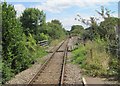
Troedyrhiw Garth railway station (site), Bridgend
Opened in 1864 on the Llynvi & Ogmore Railway's line from Pyle to Cymmer, this station closed in 1970. In 1992, the line was reopened to passengers between Bridgend and Maesteg, and a new station was opened for Garth around 100m north west of the old station.
View south east from the 1992 station, towards Llangwynydd and Bridgend.
Image: © Nigel Thompson
Taken: 16 Aug 2014
0.08 miles
2
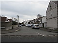
Glan yr Afon, Garth, Maesteg
Cul-de-sac on the southeast side of the B4282. Glan yr Afon
is Welsh for riverbank, in this case the south bank of the Afon Llynfi.
Image: © Jaggery
Taken: 17 Feb 2017
0.09 miles
3
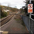
Railway from Garth towards Tondu
Viewed from Garth station http://www.geograph.org.uk/photo/4380958 looking SE along the single track Maesteg Line which crosses a bridge http://www.geograph.org.uk/photo/4367797 over Mill Street behind the small yellow milepost showing 7 (miles to Bridgend).
Image: © Jaggery
Taken: 27 Feb 2015
0.10 miles
4
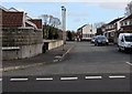
Glan yr Afon, Garth, Maesteg
Viewed across the B4282. Glan yr Afon is Welsh for riverbank, in this case the south bank of the Afon Llynfi.
Image: © Jaggery
Taken: 27 Feb 2015
0.10 miles
5
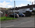
Queen Elizabeth II postbox, Fairmeadows, Garth
Near the corner of the B4282 Mill Street.
Image: © Jaggery
Taken: 24 Feb 2017
0.11 miles
6
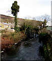
Afon Llynfi, Garth, Maesteg
The river flows away from the B4282. The Llynfi is a tributary of the River Ogmore (Afon Ogwr in Welsh).
Image: © Jaggery
Taken: 27 Feb 2015
0.11 miles
7
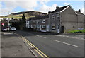
Mill Street houses, Garth
Between the corner of Fairmeadows on the right and the main entrance to Garth railway station on the left.
Image: © Jaggery
Taken: 24 Feb 2017
0.11 miles
8
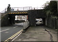
Railway bridge near Garth railway station, Maesteg
Headroom of 11' 6" is shown on the railway bridge over the B4282 Mill Street.
The entrance to Garth station is at the far end of the pedestrian underpass.
Image: © Jaggery
Taken: 17 Feb 2017
0.12 miles
9
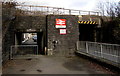
Garth railway station name sign
On the SW side of the bridge carrying the single-track Maesteg Line over the B4282 Mill Street.
Garth is on the Maesteg Line between Tondu and Ewenny Road. The terminus at Maesteg is about 1.8km away.
Image: © Jaggery
Taken: 27 Feb 2015
0.12 miles
10
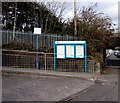
Information boards at the entrance to Garth railway station
Located alongside the station entrance path from Mill Street, the boards show railway timetables and other information. The notice on the lamppost states that Garth is not a Park & Ride station. The nearest Park & Ride facilities are at Maesteg and Tondu.
Image: © Jaggery
Taken: 27 Feb 2015
0.12 miles