1
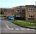
Dyffryn Place, Nantyffyllon
On the east side of Coegnant Road.
Image: © Jaggery
Taken: 27 Feb 2015
0.05 miles
2
Metcalfe Street Caerau
Looking east from Hermon Road.
Image: © Jaggery
Taken: 27 Feb 2015
0.05 miles
3
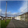
Wires over Coegnant Road, Nantyffyllon
Telephone wires extend eastwards, northeastwards and southeastwards from a tall wooden pole.
Image: © Jaggery
Taken: 27 Feb 2015
0.05 miles
4
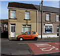
Wendy's Fish & Chips, Caerau
At 2 Coegnant Road at the southern edge of Caerau, a few metres from the Nantyffyllon boundary.
Image: © Jaggery
Taken: 27 Feb 2015
0.05 miles
5
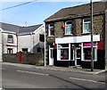
Sisterhood Salon, Caerau
Hair salon at 1A Coegnant Road at the southern edge of Caerau.
Image: © Jaggery
Taken: 27 Feb 2015
0.06 miles
6
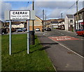
Southern boundary of Caerau
Alongside Coegnant Road. The northern boundary sign for Nantyffyllon http://www.geograph.org.uk/photo/4364753 is on the other side.
The message on both sides is Please drive carefully, and its Welsh equivalent.
Both villages are in Bridgend County Borough, north of Maesteg.
Image: © Jaggery
Taken: 27 Feb 2015
0.06 miles
7
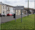
Northern boundary of Nantyffyllon
Alongside Coegnant Road. The southern boundary sign for Caerau is on the other side. http://www.geograph.org.uk/photo/4364759
The message on both sides is Please drive carefully, and its Welsh equivalent.
Both villages are in Bridgend County Borough, north of Maesteg.
Image: © Jaggery
Taken: 27 Feb 2015
0.06 miles
8
The Kingsleys, Caerau
Short row of flats viewed across Hermon Road looking towards the corner of Metcalfe Street.
Image: © Jaggery
Taken: 27 Feb 2015
0.07 miles
9
Bedw Street electricity substation, Caerau
Located on the corner of Bedw Street and Magazine Street, a few metres on the Caerau side of the Nantyffyllon boundary. The Western Power Distribution electricity substation identifier is BEDW STREET S/S 561054.
Image: © Jaggery
Taken: 27 Feb 2015
0.07 miles
10
Magazine Street, Nantyffyllon
Houses on the south side of Magazine Street. The street name may be a use of the original meaning of magazine (a storehouse for merchandise, a warehouse or depot).
Image: © Jaggery
Taken: 27 Feb 2015
0.09 miles


