1
Llynfi Coach House, Caerau
The pub at 76 Hermon Road was formerly the Royal British Legion Club.
Image: © Jaggery
Taken: 27 Feb 2015
0.02 miles
2
Former Bethany Presbyterian Chapel in Caerau
The building is on the west side of Hermon Road.
The year 1903 is inscribed on a tablet above the central window.
Image: © Jaggery
Taken: 27 Feb 2015
0.03 miles
3
Afon Llynfi footbridge in Caerau
Giving walkers from Hermon Road access to this http://www.geograph.org.uk/photo/4368762 club. Vehicular access is from Humphreys Terrace.
Image: © Jaggery
Taken: 27 Feb 2015
0.03 miles
4
The Riverboat Club, Caerau
Caerau Football Club's social club on the north side of the team's home ground, http://www.geograph.org.uk/photo/4368392 viewed across the Afon Llynfi.
Image: © Jaggery
Taken: 27 Feb 2015
0.04 miles
5
Caerau Chemist
The shop is at 68 Hermon Road, Caerau. The name Robert A. Davies is in smaller text alongside Caerau Chemist. NUMARK PHARMACIST is on the side wall.
Image: © Jaggery
Taken: 27 Feb 2015
0.04 miles
6
Glan yr Afon Court, Caerau
Located between Hermon Road and the east bank of a river, the Afon Llynfi. Glan yr Afon (Welsh for riverbank) is retirement/sheltered housing, managed by Wales & West Housing, containing 20 flats built in 1982.
Image: © Jaggery
Taken: 27 Feb 2015
0.04 miles
7
Filco supermarket, Caerau
Filco is a family-run business with several supermarkets in South Wales.
This one is in Hermon Road Caerau, on the east bank of the Llynfi River.
Image: © Jaggery
Taken: 27 Feb 2015
0.06 miles
8
Ordnance Survey Cut Mark
This OS cut mark can be found on the front of No19A Hermon Road. It marks a point 177.485m above mean sea level.
Image: © Adrian Dust
Taken: 18 Jun 2016
0.06 miles
9
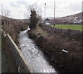
Afon Llynfi flows past a football ground in Caerau
The river flows past this http://www.geograph.org.uk/photo/4368392 football ground.
Image: © Jaggery
Taken: 27 Feb 2015
0.07 miles
10
Bramble Close, Caerau
Short row of modern houses viewed across Hermon Road.
Image: © Jaggery
Taken: 27 Feb 2015
0.07 miles


