IMAGES TAKEN NEAR TO
Duffryn Road, MAESTEG, CF34 0SS

Introduction

This page details the photographs taken nearby to Duffryn Road, CF34 0SS by members of the Geograph project.

The Geograph project started in 2005 with the aim of publishing, organising and preserving representative images for every square kilometre of Great Britain, Ireland and the Isle of Man.

There are currently over 7.5m images from over14,400 individuals and you can help contribute to the project by visiting https://www.geograph.org.uk

Image Map


Images are licensed for reuse under creativecommons.org/licenses/by-sa/2.0
Notes
  • Clicking on the map will re-center to the selected point.
  • The higher the marker number, the further away the image location is from the centre of the postcode.

Image Listing (84 Images Found)

Images are licensed for reuse under creativecommons.org/licenses/by-sa/2.0
  • ...
Image
Details
Distance
1
Ordnance Survey Cut Mark
This OS cut mark can be found on the Navigation Hotel. It marks a point 179.829m above mean sea level.
Image: © Adrian Dust Taken: 24 Nov 2020
0.02 miles
2
Caerau War Memorial
Located in Caerau Square
Image: © Jaggery Taken: 27 Feb 2015
0.02 miles
3
No through road signs in central Caerau
The Hermon Road houses are near the corner of Talana Terrace on the right. Viewed from the edge of the War Memorial http://www.geograph.org.uk/photo/4365531 in Caerau Square.
Image: © Jaggery Taken: 27 Feb 2015
0.03 miles
4
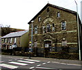
Capel y Trefnyddion
Herman Chapel in Duffryn Road - now derelict.
Image: © Alan Hughes Taken: 29 Jul 2017
0.03 miles
5
Derelict former Hermon chapel in Caerau
In February 2015, ground floor windows are boarded up. Above, many window panes are smashed. FOR SALE has been painted on the door.
Image: © Jaggery Taken: 27 Feb 2015
0.03 miles
6
Navigation Terrace, Caerau
A 30 metre long row of houses viewed across the A4063 Dyffryn Road.
Image: © Jaggery Taken: 27 Feb 2015
0.04 miles
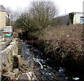
7
Llynfi River, Caerau
Viewed from the A4063 opposite this http://www.geograph.org.uk/photo/4365434 derelict chapel.
Image: © Jaggery Taken: 27 Feb 2015
0.04 miles
8
Former police station in Caerau
In February 2015, the South Wales Police nameboard seen in a Google Earth Street View in June 2011 has gone.
Image: © Jaggery Taken: 27 Feb 2015
0.05 miles
9
Houses on the west side of Hermon Street, Caerau
Looking north towards Crindau Square.
Image: © Jaggery Taken: 27 Feb 2015
0.06 miles
10
Northern end of Hermon Road, Caerau
The end house on the left is on the corner of Talana Terrace. http://www.geograph.org.uk/photo/4365347
Image: © Jaggery Taken: 27 Feb 2015
0.06 miles
  • ...