1
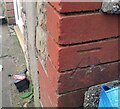
Ordnance Survey Cut Mark
This OS cut mark can be found on No3B Tonna Road. It marks a point 180.530m above mean sea level.
Image: © Adrian Dust
Taken: 10 Nov 2020
0.03 miles
2
River Llynfi flows away from a footbridge, Maesteg
Viewed from this footbridge. http://www.geograph.org.uk/photo/2698717 The Llynfi flows south towards its confluence with the River Ogmore in Aberkenfig.
Image: © Jaggery
Taken: 17 Nov 2011
0.04 miles
3
River Llynfi flows towards a footbridge, Maesteg
Viewed from this footbridge. http://www.geograph.org.uk/photo/2698717
The Llynfi is a tributary of the River Ogmore.
Image: © Jaggery
Taken: 17 Nov 2011
0.04 miles
4
Footbridge over the River Llynfi, Spelter, Maesteg
The footbridge carries a path connecting Tonna Road on the western side of the river with Coegnant Road, Heol Tywith and the Spelter Industrial Estate on the eastern (camera) side.
Image: © Jaggery
Taken: 17 Nov 2011
0.04 miles
5
Talgarth Bakery, Spelter Industrial Estate near Maesteg
Viewed from Heol Tywith. Talgarth Bakery, founded in 1904, occupies a purpose-built bakery on the Spelter Industrial Estate.
Image: © Jaggery
Taken: 17 Nov 2011
0.07 miles
6
Terraced Houses
Row of terraced housing on the A4083 above Nantyffyllon.
Image: © Alan Hughes
Taken: 29 Jul 2017
0.07 miles
7
The Construction Training Centre near Maesteg
Located in the Spelter Industrial Estate, viewed from Heol Tywith.
Opened in November 2005, the centre provides training in various aspects of construction, such as carpentry, plastering, plumbing, paving, masonry & bricklaying, painting & decorating.
Image: © Jaggery
Taken: 17 Nov 2011
0.10 miles
8
Gateway on farm track
Image: © John Lord
Taken: 10 Oct 2008
0.11 miles
9
Track down to Tonna Rd
Image: © John Lord
Taken: 10 Oct 2008
0.11 miles
10
The Vernon Hart Centre, Nantyffyllon
Day centre viewed across Heol Tywith.
Image: © Jaggery
Taken: 17 Nov 2011
0.12 miles


