1
Houses at the eastern edge of the Blaencaerau Estate, Caerau
Number 96 and number 97 Blaencaerau Estate.
Image: © Jaggery
Taken: 27 Feb 2015
0.01 miles
2
Brynglas Terrace bus stop and shelter, Blaencaerau
A timetable in the shelter shows that this is part of bus route 30, to and from Turberville via Maesteg bus station.
Image: © Jaggery
Taken: 27 Feb 2015
0.02 miles
3
Wires over Blaencaerau
Two parallel groups of three electricity power lines.
Image: © Jaggery
Taken: 27 Feb 2015
0.05 miles
4
Blaencaerau Estate electricity substation, Caerau
A label on the grey box shows that this is a Western Power Distribution electricity substation.
A much bigger electricity substation is on the hillside.
Image: © Jaggery
Taken: 27 Feb 2015
0.05 miles
5
Traffic calming in the Blaencaerau Estate, Caerau
A speed bump and a short narrowing of the road are designed to slow down vehicles in this residential area.
This is one of several similar arrangements in this area. Another one is a few tens of metres ahead.
Image: © Jaggery
Taken: 27 Feb 2015
0.06 miles
6
Boulders across the NE end of Blaencaerau Road, Caerau
The road behind the camera http://www.geograph.org.uk/photo/4430334 becomes a footpath and
cycle route beyond the boulders, part of National Cycle Network route 885.
Image: © Jaggery
Taken: 27 Feb 2015
0.06 miles
7
Towards boulders across the NE end of Blaencaerau Road, Caerau
The road behind the camera becomes a footpath and cycle route
beyond the boulders, http://www.geograph.org.uk/photo/4430389 part of National Cycle Network route 885.
Image: © Jaggery
Taken: 27 Feb 2015
0.06 miles
8
Blaencaerau Road, Caerau
Looking towards National Cycle Network route 885.
Image: © Jaggery
Taken: 27 Feb 2015
0.07 miles
9
Ordnance Survey Cut Mark
This OS cut mark can be found on No26 Blaencaerau Road. It marks a point 219.295m above mean sea level.
Image: © Adrian Dust
Taken: 24 Nov 2020
0.07 miles
10
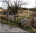
Stile to a track through a colliery tip restoration site, Caerau
The Coal Authority board at the edge of Blaencaerau Road asks you
to give the new grass and trees a chance to grow and develop. No motorcycling.
Image: © Jaggery
Taken: 27 Feb 2015
0.07 miles


