1
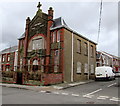
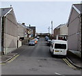
Western end of Lloyd Terrace, Caerau
Viewed from Library Road.
Image: © Jaggery
Taken: 27 Feb 2015
0.04 miles
2
Ordnance Survey Cut Mark
This OS cut mark can be found on No7 Lloyd Street. It marks a point 195.051m above mean sea level.
Image: © Adrian Dust
Taken: 24 Nov 2020
0.04 miles
3
Caerau Primary School, Caerau
Set below Greenfield Terrace and Pleasant View.
Image: © Jaggery
Taken: 27 Feb 2015
0.05 miles
4
Pleasant View, Caerau
Viewed from Greenfield Terrace. All the houses are on one side of the street,
opposite the perimeter fence of Caerau Primary School. http://www.geograph.org.uk/photo/4373550
Image: © Jaggery
Taken: 27 Feb 2015
0.05 miles
5
Unnamed street towards Carmen Street, Caerau
The street extends from Hermon Road behind the camera, past Gelli Street on the left, to Carmen Street ahead.
Image: © Jaggery
Taken: 27 Feb 2015
0.06 miles
6
Western end of Wesley Street, Caerau
Viewed across Library Road. The derelict Bethel chapel http://www.geograph.org.uk/photo/4373547 is on the left.
Image: © Jaggery
Taken: 27 Feb 2015
0.08 miles
7
Pavement mosaic in Caerau
Alongside Library Road. The mosaic depicts a winding wheel. Caerau is a former mining village.
Image: © Jaggery
Taken: 27 Feb 2015
0.08 miles
8
Derelict Bethel chapel in Caerau
In late February 2015, the boarded-up building on the corner of Library Road and Wesley Street retains the name Bethel and the year 1905 on the front wall.
Image: © Jaggery
Taken: 27 Feb 2015
0.08 miles
9
Site of the demolished Blaenllynfi Infant School in Caerau
Between Library Road and Grosvenor Terrace. The school buildings became redundant after Caerau Nursery School, Blaenllynfi Infant School and Blaencaerau Junior School amalgamated to form Caerau Primary School in September 2009. Caerau Primary School has occupied this http://www.geograph.org.uk/photo/4373550 purpose-built site since December 2009.
Image: © Jaggery
Taken: 27 Feb 2015
0.08 miles
10
Talana Terrace, Caerau
Looking towards Grosvenor Terrace.
Image: © Jaggery
Taken: 27 Feb 2015
0.09 miles


