IMAGES TAKEN NEAR TO
Heol Dyfed, MAESTEG, CF34 0PJ

Introduction

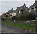
This page details the photographs taken nearby to Heol Dyfed, CF34 0PJ by members of the Geograph project.

The Geograph project started in 2005 with the aim of publishing, organising and preserving representative images for every square kilometre of Great Britain, Ireland and the Isle of Man.

There are currently over 7.5m images from over14,400 individuals and you can help contribute to the project by visiting https://www.geograph.org.uk

Image Map


Images are licensed for reuse under creativecommons.org/licenses/by-sa/2.0
Notes
  • Clicking on the map will re-center to the selected point.
  • The higher the marker number, the further away the image location is from the centre of the postcode.

Image Listing (40 Images Found)

Images are licensed for reuse under creativecommons.org/licenses/by-sa/2.0
  • ...
Image
Details
Distance
1
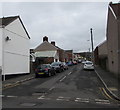
Up Duke Street, Maesteg
Duke Street ascends towards Christopher Road and Heol Dyfed.
Image: © Jaggery Taken: 17 Feb 2017
0.05 miles
2
Duke Street, Maesteg
From the corner of Heol-y-Llwyni.
Image: © Jaggery Taken: 17 Feb 2017
0.06 miles
3
2 houses on site of church, Garth
Image: © Alex McGregor Taken: 17 Jun 2011
0.08 miles
4
Heol Elfed, Maesteg
Viewed from the corner of Heol-y-Llwyni looking across Duke Street.
Image: © Jaggery Taken: 17 Feb 2017
0.09 miles
5
Across Llynvi Valley to site of Cwmdu station
View NE from B4282 in Garth, with Mynydd Bach (1,421 ft.) in the background. Cwmdu station on the ex-GWR (Port Talbot Railway) line from Port Talbot via Maesteg (to left) to Pontyrhyll (right), on which a passenger service ran until 12/9/32 and freight until 1964.
Image: © Ben Brooksbank Taken: 19 May 1990
0.10 miles
6
Peoples Trading Centre, Garth, Maesteg
Convenience store viewed across Duke Street.
Image: © Jaggery Taken: 17 Feb 2017
0.10 miles
7
Heol-y-Llwyni houses, Maesteg
Heol-y-Llwyni is on the northwest side of Duke Street.
Image: © Jaggery Taken: 17 Feb 2017
0.13 miles
8
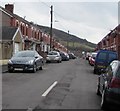
Duke Street, Maesteg
Ascending from the B4282 Bridgend Road.
Image: © Jaggery Taken: 17 Feb 2017
0.14 miles
9
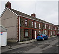
Row of stone houses, Duke Street, Maesteg
Viewed from near the Bridgend Road junction.
Image: © Jaggery Taken: 17 Feb 2017
0.15 miles
10
Turberville Street towards Maesgwyn, Maesteg
From the corner of Duke Street.
Image: © Jaggery Taken: 17 Feb 2017
0.15 miles
  • ...