1
Information board outside St Mary the Virgin church, Troedrhiwgarth, Maesteg
Located here. http://www.geograph.org.uk/photo/5289046
Image: © Jaggery
Taken: 17 Feb 2017
0.02 miles
2
St Mary the Virgin, Troedrhiwgarth, Maesteg
Church in Wales church viewed across the B4282 Bridgend Road.
Image: © Jaggery
Taken: 27 Feb 2015
0.02 miles
3
St Mary the Virgin church, Troedrhiwgarth, Maesteg
Part of the Church in Wales Diocese of Llandaff, viewed across the B4282 Bridgend Road.
Image: © Jaggery
Taken: 17 Feb 2017
0.02 miles
4
Church of St Mary the Virgin, Troedrhiwgarth, Maesteg
Image: © John Lord
Taken: 29 Aug 2008
0.03 miles
5
Fenced-off site of a former chapel, Garth, Maesteg
Between Bridgend Road and Garth Primary School, viewed in February 2017.
A disused chapel was here in 2008. http://www.geograph.org.uk/photo/941603
Image: © Jaggery
Taken: 17 Feb 2017
0.03 miles
6
Disused chapel, Garth, Maesteg
Chapel is in Bridgend Rd, B4282, Garth, Maesteg
Image: © John Lord
Taken: 29 Aug 2008
0.03 miles
7
Garden of Remembrance, Garth, Maesteg
On the north side of this http://www.geograph.org.uk/photo/4364153 church.
Image: © Jaggery
Taken: 27 Feb 2015
0.03 miles
8
Garth Senior Citizens hall, Maesteg
In a corrugated metal building on the west side of Bridgend Road.
Image: © Jaggery
Taken: 27 Feb 2015
0.04 miles
9
Garth Senior Citizens Hall, Maesteg
In a corrugated metal building on the west side of the B4282 Bridgend Road.
Image: © Jaggery
Taken: 17 Feb 2017
0.04 miles
10
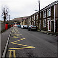
Zigzag markings on Mission Road, Garth, Maesteg
The yellow marking define the Keep Clear Zone (no stopping or parking) outside Garth Primary School.
Image: © Jaggery
Taken: 17 Feb 2017
0.05 miles


