IMAGES TAKEN NEAR TO
Cwmdu, MAESTEG, CF34 0DG
Introduction
This page details the photographs taken nearby to CF34 0DG by members of the Geograph project.
The Geograph project started in 2005 with the aim of publishing, organising and preserving representative images for every square kilometre of Great Britain, Ireland and the Isle of Man.

There are currently over 7.5m images from over14,400 individuals and you can help contribute to the project by visiting https://www.geograph.org.uk
Image Map
Images are licensed for reuse under creativecommons.org/licenses/by-sa/2.0
Notes
- Clicking on the map will re-center to the selected point.
- The higher the marker number, the further away the image location is from the centre of the postcode.
Image Listing (5 Images Found)
Images are licensed for reuse under creativecommons.org/licenses/by-sa/2.0
Image
Details
Distance
1
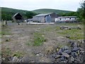
Farm Buildings At Ffos
We passed these farm buildings at Ffos en route to Garth Hill.
Image: © Rude Health
Taken: 2 Jul 2015
0.01 miles
2
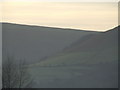
Cwmdu
This is a view of Garth hill joining the Cwmdu valley.
Image: © Jamie Murphy
Taken: 11 Mar 2007
0.09 miles
3
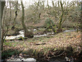
Nant Cwm-du passing through woodland (1)
Nant Cwm-du just to the north of its junction with a substantial tributary, a small portion of which can be seen at the bottom of the picture. Given its width - especially further downstream - and volume of water, the former is perhaps worthy of the status of a river rather than the brook or stream denoted by the Welsh 'nant'.
Image: © eswales
Taken: 19 Nov 2008
0.16 miles
4
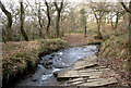
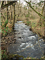
Footpath encountering ford, Cwm Du
Ford at a point in the north of the grid square where a farm track, also a public footpath, crosses a tributary of Nant Cwm-du. Unless mistaken, this is not one of the fords in the square marked on Ordnance Survey's 1:25,000 map of the area.
Image: © eswales
Taken: 19 Nov 2008
0.17 miles