IMAGES TAKEN NEAR TO
MAESTEG, CF34 0DB
Introduction
This page details the photographs taken nearby to CF34 0DB by members of the Geograph project.
The Geograph project started in 2005 with the aim of publishing, organising and preserving representative images for every square kilometre of Great Britain, Ireland and the Isle of Man.

There are currently over 7.5m images from over14,400 individuals and you can help contribute to the project by visiting https://www.geograph.org.uk
Image Map
Images are licensed for reuse under creativecommons.org/licenses/by-sa/2.0
Notes
- Clicking on the map will re-center to the selected point.
- The higher the marker number, the further away the image location is from the centre of the postcode.
Image Listing (65 Images Found)
Images are licensed for reuse under creativecommons.org/licenses/by-sa/2.0
Image
Details
Distance
1
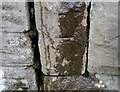
Ordnance Survey Cut Mark
This OS cut mark can be found on the wall east side of Bridgend Road. It marks a point 106.067m above mean sea level.
Image: © Adrian Dust
Taken: 11 Nov 2020
0.05 miles
2
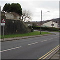
Warning sign - Playground/Lle chwarae, Garth, Maesteg
The bilingual (English/Welsh) sign faces Bridgend Road on the approach to this http://www.geograph.org.uk/photo/5289088 playground.
Image: © Jaggery
Taken: 17 Feb 2017
0.05 miles
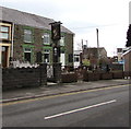
3
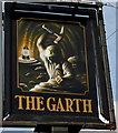
The Garth name sign, Maesteg
On a post outside this http://www.geograph.org.uk/photo/4364168 pub.
Image: © Jaggery
Taken: 27 Feb 2015
0.05 miles
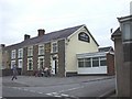
4
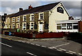
The Garth Inn, Garth, Maesteg
Pub at 140 Bridgend Road. http://www.geograph.org.uk/photo/4364173 to a view of the name sign on the left.
Image: © Jaggery
Taken: 27 Feb 2015
0.05 miles
5
The Garth Inn, Garth, Maesteg
Pub at 140 Bridgend Road in the Garth area of Maesteg.
Image: © Jaggery
Taken: 17 Feb 2017
0.05 miles
6
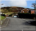
Western end of Mill View, Garth, Maesteg
Viewed across Bridgend Road along the access road to an area of about 170 houses in Mill View.
Image: © Jaggery
Taken: 27 Feb 2015
0.07 miles
7
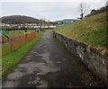
Path into a recreation ground, Garth, Maesteg
From Bridgend Road.
Image: © Jaggery
Taken: 17 Feb 2017
0.08 miles
8
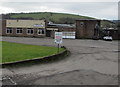
Maesteg Celtic Athletic & Social Club, Garth, Maesteg
Set back from the B4282 Bridgend Road. A nearby notice states that
the club's main hall and modern upstairs lounge are available for hire.
Image: © Jaggery
Taken: 17 Feb 2017
0.08 miles
9
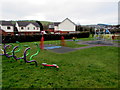
Children's play area, Garth, Maesteg
Part of a recreation ground on the west side of Bridgend Road.
Image: © Jaggery
Taken: 17 Feb 2017
0.08 miles