IMAGES TAKEN NEAR TO
New Road, CARDIFF, CF3 3EE
Introduction
This page details the photographs taken nearby to New Road, CF3 3EE by members of the Geograph project.
The Geograph project started in 2005 with the aim of publishing, organising and preserving representative images for every square kilometre of Great Britain, Ireland and the Isle of Man.

There are currently over 7.5m images from over14,400 individuals and you can help contribute to the project by visiting https://www.geograph.org.uk
Image Map
Images are licensed for reuse under creativecommons.org/licenses/by-sa/2.0
Notes
- Clicking on the map will re-center to the selected point.
- The higher the marker number, the further away the image location is from the centre of the postcode.
Image Listing (32 Images Found)
Images are licensed for reuse under creativecommons.org/licenses/by-sa/2.0
Image
Details
Distance
1
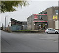
I'm Absolutely Starving, Rumney, Cardiff
Coffee, baguettes and sandwich bar located at the start of the industrial eastern half of Wentloog Road.
Image: © Jaggery
Taken: 14 Apr 2010
0.01 miles
2
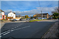
Cardiff : Wentloog Road B4239
Looking along Wentloog Road as it approaches New Road.
Image: © Lewis Clarke
Taken: 14 Nov 2018
0.04 miles
3
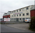
West One Express, Wentloog Road, Cardiff
Distribution centre and offices of West One Express, located near the far end of Wentloog Road.
The company's vehicle yard extends for about 150 metres along the south side of Wentloog Road, on the far side of the offices. West One Express is one of the largest independent distribution companies in South Wales.
Image: © Jaggery
Taken: 14 Apr 2010
0.06 miles
5

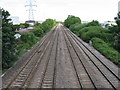
Cardiff : Railway
A railway heading into Cardiff.
Image: © Lewis Clarke
Taken: 14 Nov 2018
0.11 miles
7
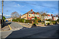
Cardiff : Wentloog Road B4239
Looking up The Grove from Wentlog Road.
Image: © Lewis Clarke
Taken: 14 Nov 2018
0.13 miles
8
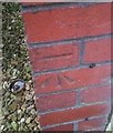
Ordnance Survey Cut Mark
This OS cut mark can be found on No132 Wentloog Road. It marks a point 13.710m above mean sea level.
Image: © Adrian Dust
Taken: 30 Dec 2018
0.13 miles
9
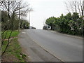
Mardy Road railway bridge, Cardiff
Viewed from the New Road side. The bridge carries Mardy Road across the South Wales main line.
There are no pavements across the bridge - a separate footbridge is on the right.
Image: © Jaggery
Taken: 14 Apr 2010
0.13 miles