
IMAGES TAKEN NEAR TO
Church Road, CARDIFF, CF3 3BB
Introduction
This page details the photographs taken nearby to Church Road, CF3 3BB by members of the Geograph project.
The Geograph project started in 2005 with the aim of publishing, organising and preserving representative images for every square kilometre of Great Britain, Ireland and the Isle of Man.

There are currently over 7.5m images from over14,400 individuals and you can help contribute to the project by visiting https://www.geograph.org.uk
Image Map
Images are licensed for reuse under creativecommons.org/licenses/by-sa/2.0
Notes
- Clicking on the map will re-center to the selected point.
- The higher the marker number, the further away the image location is from the centre of the postcode.
Image Listing (161 Images Found)
Images are licensed for reuse under creativecommons.org/licenses/by-sa/2.0
Image
Details
Distance
1

White houses, Church Road, Rumney, Cardiff
Viewed from near the corner of Wentloog Road.
Image: © Jaggery
Taken: 10 Jul 2017
0.00 miles
2
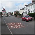
Warning sign - bends ahead, Church Road, Rumney, Cardiff
Alongside the English/Welsh SLOW/ARAF painted on the road surface.
Image: © Jaggery
Taken: 10 Jul 2017
0.01 miles
3
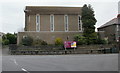
Rumney Methodist Church, Cardiff
Located on Wentloog Road, opposite the Church Road junction. The church dates from the 1950s.
Image: © Jaggery
Taken: 14 Apr 2010
0.02 miles
4
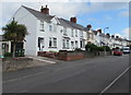
West side of Church Road, Rumney, Cardiff
North along Church Road towards Wentloog Road in the Rumney area of Cardiff.
Image: © Jaggery
Taken: 10 Jul 2017
0.04 miles
5
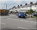
Junction of Church Road and Wentloog Road, Rumney, Cardiff
Church Road descends from Wentloog Road.
Image: © Jaggery
Taken: 10 Jul 2017
0.05 miles
6
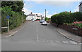
Whitehall Parade, Rumney, Cardiff
Ascending from Church Road. The sign on the left shows that this is not a through route for motor vehicles.
Image: © Jaggery
Taken: 10 Jul 2017
0.05 miles
7

The Walk, Rumney, Cardiff
From Newport Road along The Walk towards Whitehall Parade.
Image: © Jaggery
Taken: 10 Jul 2017
0.05 miles
8
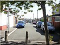
Walking The Walk, Rumney, Cardiff
Looking along The Walk from the Newport Road end, towards Whitehall Parade.
Image: © Jaggery
Taken: 9 Sep 2009
0.06 miles
9

Ordnance Survey Cut Mark
This OS cut mark can be found on No56 Church Road. It marks a point 27.228m above mean sea level.
Image: © Adrian Dust
Taken: 30 Dec 2018
0.06 miles
10

Junction of Church Road and Whitehall Parade, Rumney, Cardiff
Church Road passes the right turn into Whitehall Parade. http://www.geograph.org.uk/photo/5467821
The tower of St Augustine church http://www.geograph.org.uk/photo/5486499 is in the background.
Image: © Jaggery
Taken: 10 Jul 2017
0.06 miles