1
Kenfig Hill Clinic
The inscription in stone above the doorway of the Waunbant Road building is
CHILD WELFARE CLINIC
KENFIG HILL
1938.
Image: © Jaggery
Taken: 29 Nov 2012
0.08 miles
2
Gorgeous Grooming, Kenfig Hill
Dog grooming premises at 1 Commercial Street, opposite Prince Road.
Street name signs on the pavement show that the pink house is in Moriah Place.
Image: © Jaggery
Taken: 29 Nov 2012
0.10 miles
3
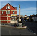
Kenfig Hill War Memorial
The War Memorial is located at the southern of Prince Road alongside the B4281 (Commercial Street and Moriah Place).
Image: © Jaggery
Taken: 29 Nov 2012
0.11 miles
4
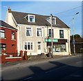
Moriah Business Centre, Kenfig Hill
The name board above the white door shows Moriah Business Centre.
Its location is on the north side of the B4281, here named Moriah Place.
Image: © Jaggery
Taken: 29 Nov 2012
0.11 miles
5
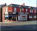
The Spices Indian takeaway, Kenfig Hill
Indian cuisine takeaway located on the corner of Moriah Place and Prince Road, opposite the War Memorial. http://www.geograph.org.uk/photo/3262756 The premises have had other occupiers in recent years, including Panda House takeaway and Lee Kee Chinese takeaway.
Image: © Jaggery
Taken: 29 Nov 2012
0.11 miles
6
South & West Country Sports, Kenfig Hill
Metal bars protect the windows of this gunsmiths' and gun dealers' premises at 14 Moriah Place,
where the right side of the South & West Country Sports name board is missing.
Image: © Jaggery
Taken: 29 Nov 2012
0.12 miles
7
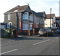
A quartet of modern houses, Moriah Place, Kenfig Hill
Located on the north side of the B4281, here named Moriah Place.
Image: © Jaggery
Taken: 29 Nov 2012
0.12 miles
8
Waunbant Road houses, Kenfig Hill
Viewed from near Kenfig Hill Clinic. http://www.geograph.org.uk/photo/3260294
Waunbant Road is also known locally as Stormy Road, because it leads to Stormy Down near Bridgend.
Image: © Jaggery
Taken: 29 Nov 2012
0.12 miles
9
Llys Ton, Kenfig Hill
Llys Ton was built in 2011 on the Waunbant Road site of the demolished Troed y Ton care home.
The purpose-built complex provides accommodation for 70 older people in 40 flats.
There is an on-site care staff, a non-resident management team and community alarm service.
The literal translation of Llys Ton is Wave Court but Ton is also the name of a nearby hill.
Image: © Jaggery
Taken: 29 Nov 2012
0.12 miles
10
J & A Antiques, Kenfig Hill
The business is at 1 Prince Road, on the corner of Commercial Street, facing the War Memorial. http://www.geograph.org.uk/photo/3262756
Image: © Jaggery
Taken: 29 Nov 2012
0.12 miles


