1
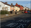
School Road, Kenfig Hill
School Road heads north away from High Street.
Image: © Jaggery
Taken: 29 Nov 2012
0.02 miles
2
Ordnance Survey Cut Mark
This OS cut mark can be found on the NW angle of St Theodore's Church. It marks a point 94.505m above mean sea level.
Image: © Adrian Dust
Taken: 4 May 2015
0.07 miles
3
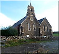
St Theodore's Church, Kenfig Hill
The church is located on the south side of High Street (the B4281) almost opposite the School Road junction. The foundation stone of St Theodore's was laid on September 19th 1889. The church is dedicated to Saint Theodore of Tarsus, who was born in Tarsus, Greece, in 602 AD. He was the eighth Archbishop of Canterbury, from 668 until his death aged 88 on September 19th 690.
Image: © Jaggery
Taken: 29 Nov 2012
0.07 miles
4
Looking from Moriah Place into High Street, Kenfig Hill
This view eastwards along the B4281 shows two street name signs.
The one on the left shows Moriah Place. The other one shows High Street.
Image: © Jaggery
Taken: 29 Nov 2012
0.07 miles
5
St.Theodore's Church, Kenfig Hill
St.Theodore's Church from the northeast.
Image: © Alan Hughes
Taken: 7 Jun 2016
0.08 miles
6
St.Theodore's Church, Kenfig Hill
St.Theodore's Church from the southwest.
Image: © Alan Hughes
Taken: 7 Jun 2016
0.08 miles
7
Red phonebox and a flight of steps, Victoria Road, Kenfig Hill
The steps ascend towards a path to School Road.
Image: © Jaggery
Taken: 29 Nov 2012
0.10 miles
8
Houses in the east of Kenfig Hill
The houses are on the north side of the B4281 in the east of Kenfig Hill,
on the approach to the western boundary of Cefn Cribwr.
Image: © Jaggery
Taken: 29 Nov 2012
0.11 miles
9
A quartet of modern houses, Moriah Place, Kenfig Hill
Located on the north side of the B4281, here named Moriah Place.
Image: © Jaggery
Taken: 29 Nov 2012
0.12 miles
10
Bend in Victoria Road, Kenfig Hill
The orientation of Victoria Road changes from W-E on the camera side
to NNE-SSW ahead, on the descent to the Station Road junction.
Image: © Jaggery
Taken: 29 Nov 2012
0.14 miles


