
IMAGES TAKEN NEAR TO
Stormy Down, BRIDGEND, CF33 4RT
Introduction
This page details the photographs taken nearby to Stormy Down, CF33 4RT by members of the Geograph project.
The Geograph project started in 2005 with the aim of publishing, organising and preserving representative images for every square kilometre of Great Britain, Ireland and the Isle of Man.

There are currently over 7.5m images from over14,400 individuals and you can help contribute to the project by visiting https://www.geograph.org.uk
Image Map
Images are licensed for reuse under creativecommons.org/licenses/by-sa/2.0
Notes
- Clicking on the map will re-center to the selected point.
- The higher the marker number, the further away the image location is from the centre of the postcode.
Image Listing (12 Images Found)
Images are licensed for reuse under creativecommons.org/licenses/by-sa/2.0
Image
Details
Distance
1
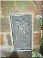
Ordnance Survey Flush Bracket (G3477)
This OS Flush Bracket can be found on the north angle of the first house in the road. It marks a point 101.294m above mean sea level.
Image: © Adrian Dust
Taken: 5 Jul 2015
0.04 miles
3
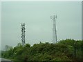
Communications Masts
Prominent feature on the lane south of the A48
Image: © Chris Shaw
Taken: Unknown
0.06 miles
4
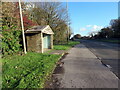
Arhosfan fysys ar ochr yr A48 / A bus stop on the A48
Arhosfan fysys ar ochr ffordd ddeuaol yr A48.
A bus stop on the A48 dual carriageway.
Image: © Alan Richards
Taken: 3 Nov 2023
0.08 miles
5
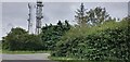
Relay Masts
It looks like much of the TV & Cell Phone coverage in the area goes through these masts
Image: © Steve Barnes
Taken: 30 Jun 2019
0.12 miles
6
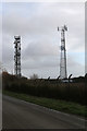
Radio base stations
Radio base stations - mobile phone transmitters
Image: © Alan Hughes
Taken: 4 Dec 2015
0.13 miles
7

Wind turbine on Stormy Down
Newly installed wind turbine on Stormy Down.
Note size of workmen on steps
Image: © Alan Hughes
Taken: 4 Dec 2015
0.14 miles
8
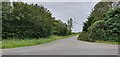
Road to Solar Farm & Wind Turbine
Both solar and wind power are gathered in this area.
Image: © Steve Barnes
Taken: 30 Jun 2019
0.15 miles
9
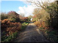
Heol i unman / Road to nowhere
Ers adeiladu'r M4 mae'r heol fach hon yn mynd i unman. Yn y pellter mae gordyfiant yn rhwystro'r ffordd.
Since the construction the M4 this minor road no longer leads to anywhere. In the distance it becomes very overgrown.
Image: © Alan Richards
Taken: 3 Nov 2023
0.18 miles
10
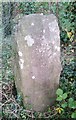
Ordnance Survey Cut Mark
This OS cut mark can be found on the stone deep in the hedge NE side of the A48. It marks a point 100.319m above mean sea level.
Image: © Adrian Dust
Taken: 7 Jun 2020
0.19 miles