1
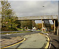
Castleton : The A48
Looking along the A48 from a footbridge.
Image: © Lewis Clarke
Taken: 14 Nov 2018
0.01 miles
2
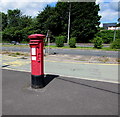
Queen Elizabeth II pillarbox, Newport Road, Castleton
Alongside a bus stop at the edge of the A48 Newport Road.
Image: © Jaggery
Taken: 14 Jul 2016
0.02 miles
3
Michaelstone and Cefn Mably direction sign, Newport Road, Castleton
Alongside the A48 Newport Road. Ahead is the right turn for Coal Pit Lane for Michaelstone and Cefn Mably.
Image: © Jaggery
Taken: 14 Jul 2016
0.02 miles
4
Bus stop at Castleton
A bus pull in off the A48. The small building by the bus stop serves as a bus shelter but, with large double doors at the back, its primary purpose appears to be to give access to the adjacent burial ground http://www.geograph.org.uk/photo/900326 .
Image: © Robin Drayton
Taken: 24 Jul 2008
0.02 miles
5
Castleton : Village Scenery
From the footbridge looking across the rooftops and out to the Bristol Channel.
Image: © Lewis Clarke
Taken: 14 Nov 2018
0.02 miles
6
Castleton : Cemetery
A cemetery opposite the Castleton Baptist Church.
Image: © Lewis Clarke
Taken: 14 Nov 2018
0.03 miles
7
Castleton Bed & Breakfast
Alongside the A48 in Castleton, about halfway between Newport and Cardiff.
The premises are for sale in July 2016.
Image: © Jaggery
Taken: 14 Jul 2016
0.03 miles
8
A48 eastbound in Castleton
Image: © Colin Pyle
Taken: 21 Sep 2015
0.03 miles
9
The Old Post Office, Castleton
This private residence on the south side of the A48 was formerly Castleton Post Office.
Image: © Jaggery
Taken: 24 Oct 2009
0.03 miles
10
Castleton footbridge
Before the opening of the nearby A48(M) and M4 motorway, the A48 through Castleton was the principal route from Newport to Cardiff, with at times very heavy amounts of traffic.
The A48 is quieter now, but a footbridge is still a safe way of avoiding the need to cross a road on which vehicles are travelling at high speed.
Signs adjacent to the footbridge give these distances (in miles)
Cardiff 7 Newport 5 Marshfield 1.
Image: © Jaggery
Taken: 24 Oct 2009
0.03 miles


