
IMAGES TAKEN NEAR TO
Bakers Court, CARDIFF, CF3 2UJ
Introduction
This page details the photographs taken nearby to Bakers Court, CF3 2UJ by members of the Geograph project.
The Geograph project started in 2005 with the aim of publishing, organising and preserving representative images for every square kilometre of Great Britain, Ireland and the Isle of Man.

There are currently over 7.5m images from over14,400 individuals and you can help contribute to the project by visiting https://www.geograph.org.uk
Image Map
Images are licensed for reuse under creativecommons.org/licenses/by-sa/2.0
Notes
- Clicking on the map will re-center to the selected point.
- The higher the marker number, the further away the image location is from the centre of the postcode.
Image Listing (108 Images Found)
Images are licensed for reuse under creativecommons.org/licenses/by-sa/2.0
Image
Details
Distance
1
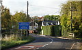
Welcome to Marshfield (from the south)
Broadway bends to the left as it approaches Marshfield. The Welsh part of the welcome sign uses Faerun, a mutated form of Maerun, the Welsh name for the village.
Image: © Jaggery
Taken: 22 Oct 2009
0.01 miles
2

Marshfield Sewage Pumping Station
Welsh Water Asset number 31318 is in a locked enclosure set back from the south side of Marshfield Road near the southeast edge of Marshfield.
Image: © Jaggery
Taken: 21 Mar 2019
0.01 miles
3
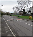
Yellow salt/grit bin near speed bumps, Marshfield Road, Marshfield
On the south side of the main road through the village.
Image: © Jaggery
Taken: 21 Mar 2019
0.01 miles
4
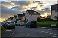
Marshfield : Pentwyn Terrace
Looking along Pentwyn Terrace from Marshfield Road.
Image: © Lewis Clarke
Taken: 14 Nov 2018
0.03 miles
5
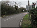
Golf course direction sign in Marshfield
The brown sign is alongside Marshfield Road, the main road through the village.
Image: © Jaggery
Taken: 21 Mar 2019
0.03 miles
6

Welcome to Marshfield - Please drive carefully
Alongside Marshfield Road near the Ty Mawr Lane junction. The sign also shows the welcome in Welsh.
Faerun is a mutated form of Maerun, the Welsh name for the village.
Viewed in March 2019. Marshfield's population was 6,270 on the day of the 2011 UK Census.
Image: © Jaggery
Taken: 21 Mar 2019
0.03 miles
7
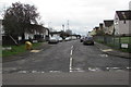
Pentwyn Terrace, Marshfield
Viewed across Marshfield Road.
Image: © Jaggery
Taken: 21 Mar 2019
0.03 miles
8

Marshfield : Marshfield Road
Looking along Marshfield Road.
Image: © Lewis Clarke
Taken: 14 Nov 2018
0.04 miles
9

Drenewydd Reen towards Marshfield
Looking to the northwest from here. https://www.geograph.org.uk/photo/6115921 Reen is the local word for drainage channel.
The blue Welcome to Marshfield sign is in the background.
Image: © Jaggery
Taken: 21 Mar 2019
0.04 miles
10

Entering Marshfield
The reen, which is flowing towards the viewpoint, has passed under the road by the welcome to Marshfield sign.
Image: © Robin Drayton
Taken: 23 Apr 2008
0.04 miles