
IMAGES TAKEN NEAR TO
Church Close, CARDIFF, CF3 2TP
Introduction
This page details the photographs taken nearby to Church Close, CF3 2TP by members of the Geograph project.
The Geograph project started in 2005 with the aim of publishing, organising and preserving representative images for every square kilometre of Great Britain, Ireland and the Isle of Man.

There are currently over 7.5m images from over14,400 individuals and you can help contribute to the project by visiting https://www.geograph.org.uk
Image Map
Images are licensed for reuse under creativecommons.org/licenses/by-sa/2.0
Notes
- Clicking on the map will re-center to the selected point.
- The higher the marker number, the further away the image location is from the centre of the postcode.
Image Listing (87 Images Found)
Images are licensed for reuse under creativecommons.org/licenses/by-sa/2.0
Image
Details
Distance
1

Turning area, Church Close, Peterstone Wentlooge
Church Close connects with the B4239 about 50 metres behind the camera.
Image: © Jaggery
Taken: 5 Mar 2023
0.01 miles
2

Bungalow, Church Close, Peterstone Wentlooge
The top of the tower of the former St Peter's Church is in the background.
The former church building is now a private house.
Image: © Jaggery
Taken: 5 Mar 2023
0.02 miles
3
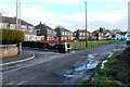
St Peters Crescent, Peterstone Wentlooge
Viewed from near the corner of Broadstreet Common (B4239)
Image: © Jaggery
Taken: 8 Jan 2011
0.02 miles
4
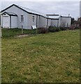
Peterstone Village Hall
Corrugated metal building in Peterstone Wentlooge viewed from Church Close.
Image: © Jaggery
Taken: 5 Mar 2023
0.03 miles
5

SW side of the village hall, Peterstone Wentlooge
Part of this https://www.geograph.org.uk/photo/7424123 corrugated metal building.
Image: © Jaggery
Taken: 5 Mar 2023
0.03 miles
6
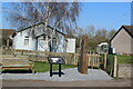
Peterstone village hall and information board
The bilingual board describes the effects of the Great Flood of 1607 and the history of the Wentlooge Sea Wall.
Image: © M J Roscoe
Taken: 3 Apr 2021
0.03 miles
8
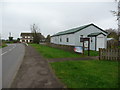
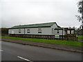
Village Hall in Peterstone Wentloog
Modernised community amenity beside the main road.
Image: © Jeremy Bolwell
Taken: 24 Oct 2012
0.03 miles
9

Tall stone marking the height of the 1607 flood, Peterstone Wentlooge
Located near the corner of the B4239 and Church Close.
The small plaque https://www.geograph.org.uk/photo/7424298 on the stone records
"This stone was commissioned to mark the flood of 1607. From where you stand
the height of the water would have been 2.2m or 7.3ft as shown by the mark above"
(The mark is near the top of the stone).
"Our thanks to the Living Levels for funding this project with help from
the local community".
Image: © Jaggery
Taken: 5 Mar 2023
0.03 miles
10

Plaque on a tall stone, Peterstone Wentlooge
On this https://www.geograph.org.uk/photo/7424272 tall stone.
Image: © Jaggery
Taken: 5 Mar 2023
0.03 miles