
IMAGES TAKEN NEAR TO
The Meadows, CARDIFF, CF3 2DY
Introduction
This page details the photographs taken nearby to The Meadows, CF3 2DY by members of the Geograph project.
The Geograph project started in 2005 with the aim of publishing, organising and preserving representative images for every square kilometre of Great Britain, Ireland and the Isle of Man.

There are currently over 7.5m images from over14,400 individuals and you can help contribute to the project by visiting https://www.geograph.org.uk
Image Map
Images are licensed for reuse under creativecommons.org/licenses/by-sa/2.0
Notes
- Clicking on the map will re-center to the selected point.
- The higher the marker number, the further away the image location is from the centre of the postcode.
Image Listing (38 Images Found)
Images are licensed for reuse under creativecommons.org/licenses/by-sa/2.0
Image
Details
Distance
1

400 yards of bends on Marshfield Road
Up to this point, Marshfield Road has been flat and mostly straight. Ahead it bends from heading northwestwards to northwards, as the steady climb to Castleton begins.
Image: © Jaggery
Taken: 22 Oct 2009
0.10 miles
2

Vicarage Gardens, Marshfield
From the junction with Marshfield Road.
Image: © Jaggery
Taken: 22 Oct 2009
0.13 miles
3
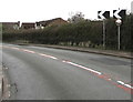
Visibility mirror at a bend in Marshfield
At a bend in Marshfield Road, the main road through the village.
Image: © Jaggery
Taken: 21 Mar 2019
0.14 miles
4

Mallards Reach, Marshfield
From Marshfield Road, Mallards Reach leads to houses in The Shires and The Meadows.
Image: © Jaggery
Taken: 21 Mar 2019
0.14 miles
5
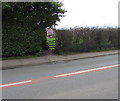
Stile between hedges, Marshfield
Giving walkers access to a public footpath through a field on the south side of Marshfield Road.
Image: © Jaggery
Taken: 21 Mar 2019
0.15 miles
6

Yellow diversion sign alongside Marshfield Road, Marshfield
On March 21st 2019 the sign states that the B4239 coast road is closed from the Broadway junction to the Heol Las junction. Follow diversion.
Image: © Jaggery
Taken: 21 Mar 2019
0.15 miles
7
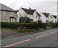
Marshfield Road houses southeast of Acorn Place, Marshfield
These houses are opposite farmland.
Image: © Jaggery
Taken: 21 Mar 2019
0.15 miles
8

Queen Elizabeth II postbox, Marshfield Road, Marshfield
On the approach to the Vicarage Gardens junction.
Image: © Jaggery
Taken: 21 Mar 2019
0.16 miles
9
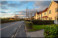
Marshfield : Marshfield Road
Looking along Marshfield Road.
Image: © Lewis Clarke
Taken: 14 Nov 2018
0.16 miles
10
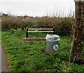
Bench and litter bin in Marshfield
Alongside Marshfield Road near Acorn Place. https://www.geograph.org.uk/photo/6093104
Image: © Jaggery
Taken: 21 Mar 2019
0.16 miles