
IMAGES TAKEN NEAR TO
Bridgend Road, BRIDGEND, CF32 9TN
Introduction
This page details the photographs taken nearby to Bridgend Road, CF32 9TN by members of the Geograph project.
The Geograph project started in 2005 with the aim of publishing, organising and preserving representative images for every square kilometre of Great Britain, Ireland and the Isle of Man.

There are currently over 7.5m images from over14,400 individuals and you can help contribute to the project by visiting https://www.geograph.org.uk
Image Map
Images are licensed for reuse under creativecommons.org/licenses/by-sa/2.0
Notes
- Clicking on the map will re-center to the selected point.
- The higher the marker number, the further away the image location is from the centre of the postcode.
Image Listing (64 Images Found)
Images are licensed for reuse under creativecommons.org/licenses/by-sa/2.0
Image
Details
Distance
1
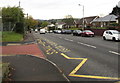
Keep Clear Zone, Bridgend Road, Bryncethin
At the edge of the A4061 Bridgend Road near an entrance to Bryncethin Primary School.
Image: © Jaggery
Taken: 11 Oct 2018
0.02 miles
2
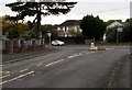
Junction of Heol Canola and the A4061, Bryncethin
The eastern end of Heol Canola joins the A4061 Bridgend Road.
Image: © Jaggery
Taken: 11 Oct 2018
0.03 miles
3
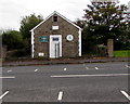
West side of Ty Capel, Bryncethin
Located here. https://www.geograph.org.uk/photo/5941921 In October 2018 signs on the building show Ty Capel Conservators of the Coity Wallia Common and Bridgend Farmers Market. The building is the former Halleluiah Methodist Chapel which was built in the early 20th century. Converted to secular use in the late 20th century.
Image: © Jaggery
Taken: 11 Oct 2018
0.03 miles
4
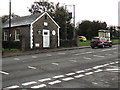
Ty Capel, Bryncethin
Located alongside the A4061 opposite the Heol Canola junction. The building is the former Halleluiah Methodist Chapel which was built in the early 20th century. Converted to secular use in the late 20th century. In October 2018 signs on the building https://www.geograph.org.uk/photo/5941929 show Ty Capel Conservators of the Coity Wallia Common and Bridgend Farmers Market.
Image: © Jaggery
Taken: 11 Oct 2018
0.03 miles
5
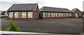
Bryncethin Primary School
The southeast side of the school viewed from Heol Canola.
Image: © Jaggery
Taken: 11 Oct 2018
0.04 miles
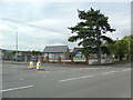
7
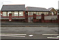
Entrance gate to Bryncethin Primary School
Behind a metal barrier on the north side of Heol Canola, the gate gives access to the SE side of the school.
Image: © Jaggery
Taken: 11 Oct 2018
0.04 miles
8
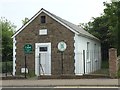
Ty Capel, Bryncoch
Ty Capel - on the western edge of the Coity Wallia commons.
Image: © Alan Hughes
Taken: 7 Jun 2016
0.04 miles
10
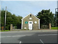
Ty Capel, Bryncoch
The stone above the door is inscribed Hallelujah; the one low Down on the left is inscribed Christ is All, June 1885. Now a conservation centre and farmers' market.
Image: © John Lord
Taken: 1 Sep 2013
0.04 miles