1
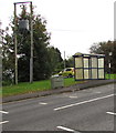
Bridgend District : The A4061
Looking towards the grassy verge on the side of the road.
Image: © Lewis Clarke
Taken: 23 Mar 2014
0.02 miles
2
Coity Wallia Common, Bryncethin
Common land viewed from this gate https://www.geograph.org.uk/photo/5940008 on the south side of Heol Canola.
Image: © Jaggery
Taken: 11 Oct 2018
0.04 miles
3
South along the A4061, Bryncethin
Viewed from the corner of Heol Canol.
Image: © Jaggery
Taken: 11 Oct 2018
0.04 miles
4
Northeast corner of Coity Wallia Common, Bryncethin
Common land viewed from here. https://www.geograph.org.uk/photo/6062646
Image: © Jaggery
Taken: 11 Oct 2018
0.06 miles
5
No riding of motorcycles or quadbikes on Coity Wallia Common
The notice is on the left here. https://www.geograph.org.uk/photo/6062646
Image: © Jaggery
Taken: 11 Oct 2018
0.08 miles
6
Entrance gate to Coity Wallia Common, Bryncethin
From the south side of Heol Canola opposite Morse Row.
Image: © Jaggery
Taken: 11 Oct 2018
0.08 miles
7
BEWARE - Chickens on patrol, Bryncethin
The notice is on the right here. https://www.geograph.org.uk/photo/6062646
Image: © Jaggery
Taken: 11 Oct 2018
0.08 miles
8
St Brides Minor Memorial Hall & Institute, Bryncethin
Heol Canola side of the hall on the corner of the A4061. The community of St Bride's Minor includes Sarn, Bryncethin and Abergarw. At the October 2018 date of this photo, the building is a community centre and is the home of ATC (Air Training Corps) 2318 Squadron Aberkenfig. https://www.geograph.org.uk/photo/5943611
Coflein records that the building opened as Bryncethin Memorial Hall on Sunday March 29th 1925. It cost £3,800 to construct. The costs were partly met through money raised from a Memorial Fund established in January 1919 (£1,000 total) and a grant of £1,500 from the Miners' Welfare Fund. Official unveiling was carried out by Finlay A. Gibson, secretary of the South Wales Coal Owners' Association.
Image: © Jaggery
Taken: 11 Oct 2018
0.08 miles
9
Millennium Plinth, Bryncethin
On the left here https://www.geograph.org.uk/photo/6063043 the plinth dated 2000 marks the new millennium.
Image: © Jaggery
Taken: 11 Oct 2018
0.08 miles
10
Line spur pole near an A4061 bus stop and shelter, Bryncethin
The line spur pole is part of the Western Power Distribution electricity supply infrastructure.
Image: © Jaggery
Taken: 11 Oct 2018
0.09 miles


