1
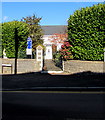
Entrance to Nazareth Baptist Chapel, Bryncethin
From the north side of Wigan Terrace near the corner of Ogmore Terrace.
Image: © Jaggery
Taken: 29 Oct 2018
0.04 miles
2
Nazareth Baptist Chapel, Bryncethin
Image: © John Lord
Taken: 1 Sep 2013
0.04 miles
3
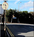
No Left Turn sign, Wigan Terrace, Bryncethin
Faded in October 2018, the sign faces westbound traffic on the approach to the Ogmore Terrace junction.
In the background, a sign alongside Ogmore Terrace shows All Traffic and the Welsh Pob Cerbyd.
Image: © Jaggery
Taken: 29 Oct 2018
0.04 miles
4
Gateway to Nazareth Baptist Chapel, Bryncethin
Image: © John Lord
Taken: 1 Sep 2013
0.04 miles
5
Ogmore Terrace, Bryncethin
North along Ogmore Terrace towards the A4065 and Abergarw.
Image: © Jaggery
Taken: 29 Oct 2018
0.06 miles
6
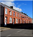
Row of brick houses, Wigan Terrace, Bryncethin
Extending for 60 metres along the north side of Wigan Terrace.
Image: © Jaggery
Taken: 29 Oct 2018
0.08 miles
7
Corner of Wigan Terrace and Highland Avenue, Bryncethin
Wigan Terrace is on the left.
Image: © Jaggery
Taken: 29 Oct 2018
0.14 miles
8
West along Wigan Terrace, Bryncethin
Viewed across the A4061 Blackmill Road from the corner of Dennis Place.
One sign shows 5 (miles) to Pontycymer. A blue sign shows Unsuitable for HGVs (heavy goods vehicles).
Image: © Jaggery
Taken: 29 Oct 2018
0.14 miles
9
Messing about on the River
Members of the Bridgend Canoe Club play in the weir(s) on the Ogmore river at Brynmenyn.
Image: © Tim Morris
Taken: 19 Dec 2004
0.14 miles
10
Wigan Terrace directions and distance sign, Bryncethin
The sign on the corner of Highland Avenue faces eastbound traffic on the approach to the A4061 junction.
Image: © Jaggery
Taken: 29 Oct 2018
0.14 miles


