1
Up Penybryn Road from Brynmenyn towards Bettws
Penybryn Road ascends from the A4065 Bryn Road in Brymenyn
towards the village of Bettws about 2.5km (a mile and a half) ahead.
Image: © Jaggery
Taken: 2 Dec 2017
0.09 miles
2
Terraced Houses
A row of terraced houses in Penybryn Road, Brynmenyn.
Image: © Alan Hughes
Taken: 20 Jan 2017
0.10 miles
3
Ascent from Brynmenyn towards Bettws
Penybryn Road ascends from the A4065 Bryn Road in Brymenyn towards
the village of Bettws about 2.5km (a mile and a half) ahead.
Image: © Jaggery
Taken: 2 Dec 2017
0.11 miles
4
Brynmenyn Common
The common is an area of Open Access Land on hillside to the north of the village. Away from footpaths much of the common is covered with thick vegetation, notably bracken. However, as can be seen, at one spot an area of short grass is maintained and a seat provided.
Image: © eswales
Taken: 5 Aug 2011
0.12 miles
5
Brynmenyn footpath
Brynmenyn footpath, from Bryngarw Park to Penybryn Hill houses
Image: © Colin Prosser
Taken: 21 May 2023
0.13 miles
6
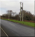
Line spur pole above a Brynmenyn corner
The Western Power Distribution line spur pole is alongside
Penybryn Road above the corner of the A4065 Bryn Road in Brynmenyn.
Image: © Jaggery
Taken: 2 Dec 2017
0.13 miles
7
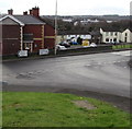
Yellow houses behind a Bryn Road bus stop and shelter, Brynmenyn
The houses are above the corner of Bryn Road and Penybryn Road.
Image: © Jaggery
Taken: 2 Dec 2017
0.14 miles
8
Junction at the bottom of Penybryn Road, Brynmenyn
At the end of the long descent from the village of Bettws, turn left into
the A4065 Bryn Road for Bryncethin and Bridgend. Turn right for Aberkenfig and Tondu.
Image: © Jaggery
Taken: 2 Dec 2017
0.15 miles
9
Ordnance Survey Cut Mark
This OS cut mark can be found on the wall of No168 Bryn Road. It marks a point 58.878m above mean sea level.
Image: © Adrian Dust
Taken: 5 Sep 2021
0.15 miles
10
Bettws direction and distance sign, Bryn Road, Brynmenyn
Facing the A4065 Bryn Road on the approach to the Penybryn Road junction. https://www.geograph.org.uk/photo/5617555
Image: © Jaggery
Taken: 2 Dec 2017
0.15 miles


