
IMAGES TAKEN NEAR TO
Tondu, BRIDGEND, CF32 9HF
Introduction
This page details the photographs taken nearby to CF32 9HF by members of the Geograph project.
The Geograph project started in 2005 with the aim of publishing, organising and preserving representative images for every square kilometre of Great Britain, Ireland and the Isle of Man.

There are currently over 7.5m images from over14,400 individuals and you can help contribute to the project by visiting https://www.geograph.org.uk
Image Map
Images are licensed for reuse under creativecommons.org/licenses/by-sa/2.0
Notes
- Clicking on the map will re-center to the selected point.
- The higher the marker number, the further away the image location is from the centre of the postcode.
Image Listing (6 Images Found)
Images are licensed for reuse under creativecommons.org/licenses/by-sa/2.0
Image
Details
Distance
1
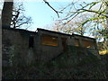
WWII remains nr Tondu House
During and after World War Two this site was the Ministry of Supply's Pyrotechnic Research Department, attached to the Royal Ordnance Factory at Brackla Small to medium weapons were developed here; work at the laboratories ended in 1957. Formerly the house was occupied by the owner of a local mine and brickworks and later owned by the National Coal Board. - Source Coflein
Image: © John Finch
Taken: 17 Dec 2013
0.02 miles
2
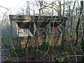
More WWII remains nr Tondu House
During and after World War Two this site was the Ministry of Supply's Pyrotechnic Research Department, attached to the Royal Ordnance Factory at Brackla (nprn 308124). Small to medium weapons were developed here; work at the laboratories ended in 1957. Formerly the house was occupied by the owner of a local mine and brickworks and later owned by the National Coal Board; it was demolished after 1963. - Source Coflein
Image: © John Finch
Taken: 17 Dec 2013
0.05 miles
3
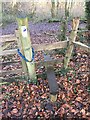
Stile and Footpath
Stile and footpath through Coed Tondu.
Image: © Alan Hughes
Taken: 3 Jan 2017
0.12 miles
4
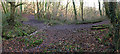
Woodland Path
Woodland path through Coed Tondu.
Image: © Alan Hughes
Taken: 3 Jan 2017
0.13 miles
5
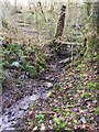
Footbridge and Stream
Footbridge over stream in Coed Tondu.
Image: © Alan Hughes
Taken: 3 Jan 2017
0.14 miles
6
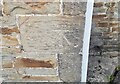
Ordnance Survey Cut Mark
This OS cut mark can be found on No25 Derllwyn Road. It marks a point 88.502m above mean sea level.
Image: © Adrian Dust
Taken: 13 Oct 2021
0.21 miles