1
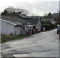
Minor junction, Station Approach, Tondu
On the right, an unnamed dead-end side road diverges from Station Approach.
Ahead for Tondu railway station. Behind the camera for the A4065 Bryn Road.
Image: © Jaggery
Taken: 27 Nov 2017
0.01 miles
2
Water channel near Station Approach, Tondu
Image: © Jaggery
Taken: 27 Nov 2017
0.01 miles
3
Tondu
Tondu, a watercourse on side of the old road leading to Tondu station, the old road went off to the right down the hill commonly known as Waterwheel Hill, there was a waterwheel here for Felin Fach colliery, under the railway bridge
Image: © Colin Prosser
Taken: 26 Mar 2021
0.02 miles
4
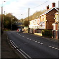
Station Approach houses, Tondu
Ahead for the A4065 Bryn Road. Behind the camera for Tondu railway station.
Image: © Jaggery
Taken: 27 Nov 2017
0.02 miles
5
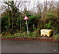
Yellow salt/grit box, Station Approach, Tondu
On the right here https://www.geograph.org.uk/photo/6642252 next to a warning sign on a non-perpendicular pole.
Image: © Jaggery
Taken: 27 Nov 2017
0.03 miles
6
Bend in Station Approach, Tondu
Ahead for the A4065 Bryn Road. Behind the camera for Tondu railway station.
Image: © Jaggery
Taken: 27 Nov 2017
0.04 miles
7
Station Approach name sign, Tondu
The sign on the corner of the A4065 Bryn Road is on the right here. https://www.geograph.org.uk/photo/6648875
Image: © Jaggery
Taken: 27 Nov 2017
0.04 miles
8
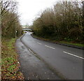
Bryn Road towards a railway bridge, Tondu
West along the A4065 Bryn Road towards a railway bridge south of Tondu railway station.
Image: © Jaggery
Taken: 2 Dec 2017
0.04 miles
9
Bryn Road towards a railway bridge, Tondu
From the corner of Station Approach along the A4065 Bryn Road
towards the railway bridge south of Tondu station.
Image: © Jaggery
Taken: 27 Nov 2017
0.04 miles
10
Southern end of Station Approach, Tondu
Viewed across the A4065 Bryn Road. The black arrow on the sign on the right points north towards Tondu railway station and car park about 200 metres ahead. The Station Approach name sign https://www.geograph.org.uk/photo/6642284 is also on the right.
Image: © Jaggery
Taken: 27 Nov 2017
0.04 miles


