IMAGES TAKEN NEAR TO
Derllwyn Road, BRIDGEND, CF32 9DL

Introduction

This page details the photographs taken nearby to Derllwyn Road, CF32 9DL by members of the Geograph project.

The Geograph project started in 2005 with the aim of publishing, organising and preserving representative images for every square kilometre of Great Britain, Ireland and the Isle of Man.

There are currently over 7.5m images from over14,400 individuals and you can help contribute to the project by visiting https://www.geograph.org.uk

Image Map


Images are licensed for reuse under creativecommons.org/licenses/by-sa/2.0
Notes
  • Clicking on the map will re-center to the selected point.
  • The higher the marker number, the further away the image location is from the centre of the postcode.

Image Listing (56 Images Found)

Images are licensed for reuse under creativecommons.org/licenses/by-sa/2.0
  • ...
Image
Details
Distance
1
Ordnance Survey Cut Mark
This OS cut mark can be found on the wall north side of Derllwyn Road. It marks a point 72.372m above mean sea level.
Image: © Adrian Dust Taken: 5 Sep 2021
0.08 miles
2
Tondu Ironworks
Remains of the Tondu Ironworks which operated from 1820 to 1895
Image: © Stephen Dewhirst Taken: 8 Sep 2003
0.12 miles
3
Ordnance Survey Cut Mark
This OS cut mark can be found on No25 Derllwyn Road. It marks a point 88.502m above mean sea level.
Image: © Adrian Dust Taken: 13 Oct 2021
0.13 miles
4
Derllwyn Road, Tondu
Looking west across Maesteg Road. Distances shown are 1½ (miles) to Ffordd-y-gyfraith, 2½ to Aber-baiden and 4 to Pen-y-bryn.
Image: © Jaggery Taken: 28 Oct 2014
0.14 miles
5
Tondu Ironworks
Formally Tondu Ironworks, now a heritage site
Image: © Colin Prosser Taken: 17 Jan 2021
0.15 miles
6
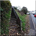
Long flight of steps up from Maesteg Road, Tondu
The steps extend for 30 metres (about 100 ft) to the edge of houses in Parc Derllwyn.
Image: © Jaggery Taken: 28 Oct 2014
0.17 miles
7
Side road ascends from Maesteg Road, Tondu
Drivers descending the side road have this mirror http://www.geograph.org.uk/photo/4223402 facing them at the junction to increase the field of view of traffic on the busy A4063 Maesteg Road.
Image: © Jaggery Taken: 28 Oct 2014
0.18 miles
8
Ordnance Survey Cut Mark
This OS cut mark can be found on the wall SW side of Maesteg Road. It marks a point 57.141m above mean sea level.
Image: © Adrian Dust Taken: 5 Sep 2021
0.18 miles
9
Change of house type, Maesteg Road, Tondu
Houses on the east side of Maesteg Road
Image: © Jaggery Taken: 28 Oct 2014
0.18 miles
10
Into the Llynfi Valley, Tondu
The brown sign is alongside the A4063 Maesteg Road.
Image: © Jaggery Taken: 28 Oct 2014
0.18 miles
  • ...