
IMAGES TAKEN NEAR TO
Derllwyn Road, BRIDGEND, CF32 9DG
Introduction
This page details the photographs taken nearby to Derllwyn Road, CF32 9DG by members of the Geograph project.
The Geograph project started in 2005 with the aim of publishing, organising and preserving representative images for every square kilometre of Great Britain, Ireland and the Isle of Man.

There are currently over 7.5m images from over14,400 individuals and you can help contribute to the project by visiting https://www.geograph.org.uk
Image Map
Images are licensed for reuse under creativecommons.org/licenses/by-sa/2.0
Notes
- Clicking on the map will re-center to the selected point.
- The higher the marker number, the further away the image location is from the centre of the postcode.
Image Listing (72 Images Found)
Images are licensed for reuse under creativecommons.org/licenses/by-sa/2.0
Image
Details
Distance
1
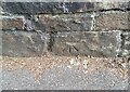
Ordnance Survey Cut Mark
This OS cut mark can be found on the wall north side of Derllwyn Road. It marks a point 72.372m above mean sea level.
Image: © Adrian Dust
Taken: 5 Sep 2021
0.03 miles
2
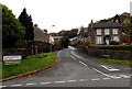
Derllwyn Road, Tondu
Looking west across Maesteg Road.
Distances shown are 1½ (miles) to Ffordd-y-gyfraith, 2½ to Aber-baiden and 4 to Pen-y-bryn.
Image: © Jaggery
Taken: 28 Oct 2014
0.03 miles
3
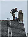
A head for heights
Repair work on a chimney stack.
Image: © Alan Hughes
Taken: 17 Jan 2021
0.08 miles
4
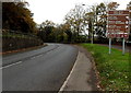
Into the Llynfi Valley, Tondu
The brown sign is alongside the A4063 Maesteg Road.
Image: © Jaggery
Taken: 28 Oct 2014
0.08 miles
5
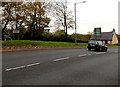
Northern boundary of Tondu
The A4063 Maesteg Road passes the boundary sign on the left.
Tondu (pronounced Ton-dee) is a village in the County Borough of Bridgend.
Image: © Jaggery
Taken: 28 Oct 2014
0.08 miles
6
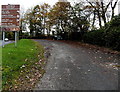
Llynfi Valley Cycle Route, Tondu
Here alongside the A4063 Maesteg Road, this is a combined footpath and cycle route, part of National Cycle Network route 885.
Image: © Jaggery
Taken: 28 Oct 2014
0.09 miles
7
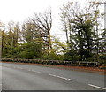
Mirror at the edge of Maesteg Road, Tondu
The mirror on a pole on the right is opposite a side road junction. http://www.geograph.org.uk/photo/4223414
Image: © Jaggery
Taken: 28 Oct 2014
0.09 miles
8
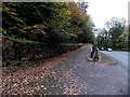
Side road ascends from Maesteg Road, Tondu
Drivers descending the side road have this mirror http://www.geograph.org.uk/photo/4223402 facing them
at the junction to increase the field of view of traffic on the busy A4063 Maesteg Road.
Image: © Jaggery
Taken: 28 Oct 2014
0.09 miles
9
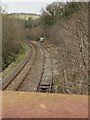
Llynfi Valley Railway
View from Coedtrehên Bridge northwards towards Maesteg.
See also Image]
Image: © Alan Hughes
Taken: 17 Jan 2021
0.09 miles
10
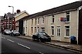
Change of house type, Maesteg Road, Tondu
Houses on the east side of Maesteg Road
Image: © Jaggery
Taken: 28 Oct 2014
0.09 miles