1
Rooftop solar panels, Maesteg Road, Tondu
Viewed across the A4063 Maesteg Road.
Image: © Jaggery
Taken: 27 Nov 2017
0.00 miles
2
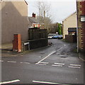
Junction of Maesteg Road and Cross Street, Tondu
Looking across Maesteg Road into Cross Street. http://www.geograph.org.uk/photo/5612556
Image: © Jaggery
Taken: 27 Nov 2017
0.01 miles
3
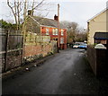
Maesteg Road houses in Tondu
Houses on the west side of the road. The gap in the houses on the right is the Cross Street junction.
Image: © Jaggery
Taken: 28 Oct 2014
0.01 miles
4
Old Milepost by the A4063, Maesteg Road, Tondu
Milepost by the A4063, in parish of Newcastle Higher (Bridgend County Borough District), Tondu, on Maesteg Road, immediately outside Tondu Methodist Church, West side of road.
Inscription reads:-
: MAESTEG / 6 / MILES : : RAILWAY / STATION / 3¼ : : BRIDGEND / 3 / MILES :
Grade II listed by Cadw.
Reference Number: 19053 https://cadwpublic-api.azurewebsites.net/reports/listedbuilding/FullReport?lang=&id=19053
Surveyed
Milestone Society National ID: GLA_MSBE06
Image: © Milestone Society
Taken: Unknown
0.02 miles
5
Tondu
Tondu, viewed from the cycletrack, a bridge on Maesteg Road, the old incline from near Park Terrace Tondu went under here, to the main line at Tondu, which fed the washery, commonly known as The Belgiums, and wagons were hauled up the incline to The Copes
Image: © Colin Prosser
Taken: 1 Mar 2021
0.02 miles
6
Milestone marker
Victorian cast iron milestone on the A 4063 at Tondu.
Image: © Alan Hughes
Taken: 17 Jan 2021
0.02 miles
7
Tondu
Tondu, on the wall at rear of pavement, outside Wesleyan Church, mileage marker.
Image: © Colin Prosser
Taken: 26 Feb 2021
0.02 miles
8
Cross Street, Tondu
Dead-end street on the east side of Maesteg Road.
Image: © Jaggery
Taken: 27 Nov 2017
0.02 miles
9
Footpath and cycle route, Tondu
Heading west away from Maesteg Road near Cross Street, part of National Cycle Network Route 4.
Image: © Jaggery
Taken: 28 Oct 2014
0.03 miles
10
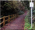
Permissive Cycle Track, Tondu
Part of National Cycle Network Route 4, here on the west side of the A4063 Maesteg Road.
The sign on the right shows PERMISSIVE CYCLE TRACK and the Welsh equivalent.
Image: © Jaggery
Taken: 27 Nov 2017
0.03 miles


