1
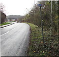
Openreach van in Tondu
Viewed across the A4065 Bryn Road in November 2017.
Two dark green telecoms cabinets are nearby.
Image: © Jaggery
Taken: 27 Nov 2017
0.04 miles
2
Distances from Tondu
Signs on the east side of the A4065 Bryn Road 3 (miles) from Llangeinor, 6 from Pontycymer, 6 from Ogmore Vale, 2 from Bryncethin, 1 from Brynmenyn.
Image: © Jaggery
Taken: 27 Nov 2017
0.04 miles
3
KEEP CLEAR on Bryn Road, Tondu
Text painted on the surface of the A4065 Bryn Road.
Image: © Jaggery
Taken: 27 Nov 2017
0.04 miles
4
RJD Motor Services, Tondu
In Tondu Enterprise Centre accessed from the A4065 Bryn Road opposite Station Approach. Maximum speed 10mph.
Image: © Jaggery
Taken: 27 Nov 2017
0.05 miles
5
Railway bridge near the southern boundary of Tondu
The bridge carries a railway across Maesteg Road. The Tondu boundary sign http://www.geograph.org.uk/photo/3391620 is on the far side of the bridge. Tondu railway station is to the right, about 400 metres NNE of the bridge.
Image: © Jaggery
Taken: 27 Mar 2013
0.06 miles
6
Towards a bend in Bryn Road, Tondu
Looking to the SSW along the A4065 Bryn Road from near the corner of Station Approach.
Image: © Jaggery
Taken: 27 Nov 2017
0.06 miles
7
Cycle Route 4 direction sign, Bryn Road, Tondu
On a pole that is not perpendicular in November 2017, the white arrow on the small sign points along National Cycle Network Route 4, a long-distance route from London to Fishguard.
Image: © Jaggery
Taken: 27 Nov 2017
0.06 miles
8
Carey chapel Aberkenfig August 17th 2015
Demolition begins of old Carey chapel Aberkenfig, to make way for new housing complex.
Image: © Colin Prosser
Taken: 17 Aug 2015
0.07 miles
9
Carey chapel Aberkenfig January 18th 2015
Carey chapel Aberkenfig just a few months before demolition to make way for new housing complex.
Image: © Colin Prosser
Taken: 18 Jan 2015
0.07 miles
10
Entrance to Tondu Enterprise Centre, Tondu
From the A4065 Bryn Road opposite Station Approach viewed in November 2017.
Image: © Jaggery
Taken: 27 Nov 2017
0.07 miles


