1
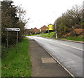
Hazel Mead, Brynmenyn
Cul-de-sac below the south side of the A4065 Bryn Road.
Image: © Jaggery
Taken: 2 Dec 2017
0.01 miles
2
Brynmenyn railway
Brynmenyn to Tondu, now disused railway line
Image: © Colin Prosser
Taken: 12 Feb 2023
0.03 miles
3
Brynmenyn
Brynmenyn disused railway direction view towards Tondu
Image: © Colin Prosser
Taken: 12 Feb 2023
0.03 miles
4
Hazel Mead/Maes Collen name sign, Brynmenyn
The English/Welsh sign is on the corner of the A4065 Bryn Road.
Image: © Jaggery
Taken: 2 Dec 2017
0.04 miles
5
Bettws direction and distance sign, Bryn Road, Brynmenyn
Facing westbound traffic on the A4065 Bryn Road on the approach to the Penybryn Road junction. https://www.geograph.org.uk/photo/5617555
Image: © Jaggery
Taken: 2 Dec 2017
0.04 miles
6
Warning sign - School, Bryn Road, Brynmenyn
Facing the A4065 Bryn Road on the approach to the entrance to Brynmenyn Primary School. https://www.geograph.org.uk/photo/5633434
Image: © Jaggery
Taken: 2 Dec 2017
0.04 miles
7
Disused railway, Brynmenyn
A westward view along the Garw Valley Railway from a foot crossing on a public footpath.
Image: © eswales
Taken: Unknown
0.05 miles
8
Corrugated metal hall in Brynmenyn
The hall is alongside Bethlehem Presbyterian Chapel. http://www.geograph.org.uk/photo/5617599
Image: © Jaggery
Taken: 2 Dec 2017
0.05 miles
9
Brynmenyn
Brynmenyn, near the old railway station, the now disused railway which ran from Tondu to the Garw Valley Ogmore Valley also Gilfach Heol y Cyw Brynna
Image: © Colin Prosser
Taken: 2 Jan 2021
0.05 miles
10
Railway crossing, Brynmenyn
A photograph showing a warning sign at the northern side of a foot crossing over the single track Garw Valley Railway. From the point seen, some steps take one down to the line. The railway is not currently (December 2012) in use though it is hoped that in the future trains will again run on it.
The crossing is on a short stretch of public footpath north of National Cycle Route 4 which is marked on Ordnance Survey’s 1:25,000 map of the area.
Image: © eswales
Taken: Unknown
0.05 miles


