1
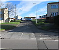
Tudor Drive, Bettws
Ascending from the east side of Bettws Road, Tudor Drive leads to Tyn y Bettws Close.
Image: © Jaggery
Taken: 24 Nov 2017
0.07 miles
2
Heol y Felin, Bettws
Ascending from the east side of Bettws Road.
Image: © Jaggery
Taken: 24 Nov 2017
0.08 miles
3
Bungalows above Bettws Road, Bettws
Originally, bungalow was used in English for a lightly-built house, with a veranda and one storey.
In current UK usage it is a convenient word for any one-storey dwelling.
Image: © Jaggery
Taken: 24 Nov 2017
0.08 miles
4
Department for Transport cabinet in the south of Bettws
Set back from the west side of Bettws Road.
Image: © Jaggery
Taken: 24 Nov 2017
0.11 miles
5
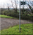
Bilingual public footpath sign, Bettws
At the edge of Bettws Road pointing towards this http://www.geograph.org.uk/photo/5609472 public footpath which is llwybr troed cyhoeddus in Welsh.
Image: © Jaggery
Taken: 24 Nov 2017
0.12 miles
6
Traffic-calming Bettws
Photograph shows the pinch-point where the road comes into Bettws at the south
Image: © John Lord
Taken: 29 Aug 2008
0.12 miles
7
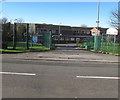
Start of the 30 zone at the southern edge of Bettws
The National Speed Limit on Bettws Road drops to 30mph.
See http://www.geograph.org.uk/photo/5609491 for a closer view of the structure on the left.
Image: © Jaggery
Taken: 24 Nov 2017
0.12 miles
8
Small Christmas tree in a pot on a Bettws Road lamppost, Bettws
Viewed on November 24th 2017.
Image: © Jaggery
Taken: 24 Nov 2017
0.13 miles
9
Trem-y-mor, Bettws
Residential care home on the west side of Bettws Road.
Image: © Jaggery
Taken: 24 Nov 2017
0.13 miles
10
Woodland in the lower Garw Valley
A view from the Garw Valley Community Route showing part of the wood Coed Gwilym, near Bettws, on hillside on the west side of the valley. Part of the land occupied by this wood is classed as ancient woodland. The trees nearer the camera are growing beside the Afon Garw.
Image: © eswales
Taken: Unknown
0.13 miles


