IMAGES TAKEN NEAR TO
Lower Church Street, BRIDGEND, CF32 8LA

Introduction

This page details the photographs taken nearby to Lower Church Street, CF32 8LA by members of the Geograph project.

The Geograph project started in 2005 with the aim of publishing, organising and preserving representative images for every square kilometre of Great Britain, Ireland and the Isle of Man.

There are currently over 7.5m images from over14,400 individuals and you can help contribute to the project by visiting https://www.geograph.org.uk

Image Map


Images are licensed for reuse under creativecommons.org/licenses/by-sa/2.0
Notes
  • Clicking on the map will re-center to the selected point.
  • The higher the marker number, the further away the image location is from the centre of the postcode.

Image Listing (96 Images Found)

Images are licensed for reuse under creativecommons.org/licenses/by-sa/2.0
  • ...
Image
Details
Distance
1
Ordnance Survey Cut Mark
This OS cut mark can be found on the wall of No13 Lower Church Street. It marks a point 184.441m above mean sea level.
Image: © Adrian Dust Taken: 29 May 2017
0.01 miles
2
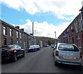
Lower Church Street, Pontcymer
One of three parallel streets on the south side of Richard Street. The other two are Church Street and High Street.
Image: © Jaggery Taken: 1 Sep 2014
0.02 miles
3
Ordnance Survey Cut Mark
This OS cut mark can be found on the wall of No15 Church Street. It marks a point 197.895m above mean sea level.
Image: © Adrian Dust Taken: 29 May 2017
0.03 miles
4
Unusual High Street in Pontycymer
Looking SSE from Richard Street. Unusually for a High Street in the UK, there are no shops here. The main shopping street in this area is Oxford Street, about 70 metres away.
Image: © Jaggery Taken: 1 Sep 2014
0.03 miles
5
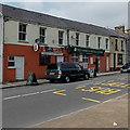
Vetz Sports & Social Club, Pontycymer
Located at 159-165 Oxford Street. Previously named Vetz Snooker Club.
Image: © Jaggery Taken: 6 Sep 2014
0.08 miles
6
Hillside bank reinforcement in a Pontycymer car park
Opposite Vetz Sports & Social Club. http://www.geograph.org.uk/photo/4153287
Image: © Jaggery Taken: 6 Sep 2014
0.08 miles
7
Unnamed street up to Nantyrychain Terrace, Pontycymer
Viewed from Oxford Street.
Image: © Jaggery Taken: 6 Sep 2014
0.08 miles
8
Ordnance Survey Cut Mark
This OS cut mark can be found on the wall angle on Nantyrychain Terrace. It marks a point 164.833m above mean sea level.
Image: © Adrian Dust Taken: 29 May 2017
0.08 miles
9
Ordnance Survey Cut Mark
This OS cut mark can be found on the wall of No17 Ivor Street. It marks a point 183.685m above mean sea level.
Image: © Adrian Dust Taken: 29 May 2017
0.09 miles
10
School Terrace, Pontycymer
Short street between Ivor Street and Ffaldau Primary School http://www.geograph.org.uk/photo/4150655 on this side, and Richard Street ahead.
Image: © Jaggery Taken: 1 Sep 2014
0.09 miles
  • ...