
IMAGES TAKEN NEAR TO
Alexandra Road, BRIDGEND, CF32 8HB
Introduction
This page details the photographs taken nearby to Alexandra Road, CF32 8HB by members of the Geograph project.
The Geograph project started in 2005 with the aim of publishing, organising and preserving representative images for every square kilometre of Great Britain, Ireland and the Isle of Man.

There are currently over 7.5m images from over14,400 individuals and you can help contribute to the project by visiting https://www.geograph.org.uk
Image Map
Images are licensed for reuse under creativecommons.org/licenses/by-sa/2.0
Notes
- Clicking on the map will re-center to the selected point.
- The higher the marker number, the further away the image location is from the centre of the postcode.
Image Listing (122 Images Found)
Images are licensed for reuse under creativecommons.org/licenses/by-sa/2.0
Image
Details
Distance
1
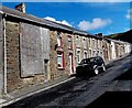
Boarded-up house in Alexandra Road, Pontycymer
Viewed in early September 2014. The house has been boarded up for more than three years.
Its appearance was similar in a Google Earth Street View taken in June 2011.
Image: © Jaggery
Taken: 1 Sep 2014
0.04 miles
2
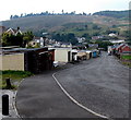
Down Federation Lane, Pontycymer
Federation Lane descends towards Meadow Street from the corner of Park Street. http://www.geograph.org.uk/photo/4162985
Image: © Jaggery
Taken: 6 Sep 2014
0.04 miles
3
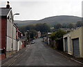
Federation Lane, Pontycymer
Looking east from the Meadow Street end, towards Park Street.
Image: © Jaggery
Taken: 6 Sep 2014
0.05 miles
4
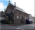
Derelict former church for sale, Pontycymer
In early September 2014, there was a FOR SALE sign outside this building on the corner of Alexandra Road and Meadow Street. When last used for worship, it was a United Reformed Church. It was built as an English Congregational Church in the first decade of the 20th century to replace the first church here, a zinc chapel. Grade II listed status (1997) has not prevented the building's dereliction.
Image: © Jaggery
Taken: 1 Sep 2014
0.05 miles
5
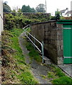
Track from Park Street to Alexandra Road, Pontycymer
From the southern end of Park Street. http://www.geograph.org.uk/photo/4162985
Image: © Jaggery
Taken: 6 Sep 2014
0.06 miles
6
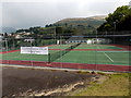
Garw Valley Tennis Club, Pontycymer
Three tennis courts viewed from Federation Lane near the corner of Park Street.
Image: © Jaggery
Taken: 6 Sep 2014
0.07 miles
7
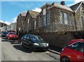
Ffaldau Primary School, Pontycymer
This is the Albany Road side of the school which extends south to Ivor Street.
Image: © Jaggery
Taken: 1 Sep 2014
0.07 miles
8

Steep ascent along Alexandra Road, Pontycymer
Looking east from the corner of Oxford Street.
Image: © Jaggery
Taken: 1 Sep 2014
0.07 miles
9
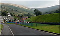
Meadow Street children's playground in Pontycymer
The long, narrow play area extends for about 60 metres along the east side of Meadow Street.
Image: © Jaggery
Taken: 6 Sep 2014
0.07 miles
10
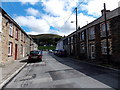
Waun Bant, Pontycymer
Looking east along the street named Want Bant (some sources show
Gwaun Bant) towards the greenness of a sports and other recreation area.
Image: © Jaggery
Taken: 1 Sep 2014
0.08 miles