1
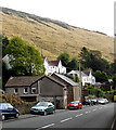
Houses and a hillside above Tylagwyn
Viewed across the A4064.
Image: © Jaggery
Taken: 6 Sep 2014
0.01 miles
2
Foundation stone, Tylagwyn Baptist Chapel
In the wall on the right here. http://www.geograph.org.uk/photo/4160254
Image: © Jaggery
Taken: 6 Sep 2014
0.01 miles
3
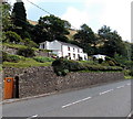
Former Tylagwyn Baptist Chapel
Former chapel converted to residential use, viewed across the A4064 in Tylagwyn above the Garw Valley. The foundation stone http://www.geograph.org.uk/photo/4160257 shows 1888, the year of the rebuild of the original 1831 chapel.
Image: © Jaggery
Taken: 6 Sep 2014
0.01 miles
4
Queen Elizabeth II postbox on a post in Tylagwyn
Outside the former Tylagwyn Baptist Chapel. http://www.geograph.org.uk/photo/4160254
Image: © Jaggery
Taken: 6 Sep 2014
0.01 miles
5
Coal heads south from the valleys
Image: © roger geach
Taken: 1 May 1992
0.01 miles
6
Chapel at Tylagwyn
Chapel y Bedyddwyr, 1831, Tylagwyn.
Image: © Alan Hughes
Taken: 19 Jan 2017
0.02 miles
7
Chapel at Tylagwyn
Welsh chapel on A4064 at Tylagwyn.
Image: © Alan Hughes
Taken: 17 Aug 2019
0.02 miles
8
Former railway route, Tylagwyn
Looking NNW from this http://www.geograph.org.uk/photo/4160404 bridge. Some sources state that the track is intact here. That may be so, but all this is visible is one rusty rail on the right side of the path. Perhaps the rest of the track is under the vegetation. The houses are alongside the A4064 in Tylagwyn.
Image: © Jaggery
Taken: 6 Sep 2014
0.03 miles
9
Cycle path and disused railway, Tylagwyn
The path followed by Route 884 of the National Cycle Network – a.k.a. The Garw Valley Community Route – seen as it passes beneath the road West Rhonnda. As it does for most of its length, the path here runs alongside The Garw Valley Railway. This railway is not currently (2013) in use.
Image: © eswales
Taken: Unknown
0.04 miles
10
The Cottage, Tylagwyn
On the hillside above the A4064, The Cottage faces the Garw Valley and the hills beyond.
Image: © Jaggery
Taken: 6 Sep 2014
0.04 miles


