IMAGES TAKEN NEAR TO
Convil Road, BRIDGEND, CF32 8BN

Introduction

This page details the photographs taken nearby to Convil Road, CF32 8BN by members of the Geograph project.

The Geograph project started in 2005 with the aim of publishing, organising and preserving representative images for every square kilometre of Great Britain, Ireland and the Isle of Man.

There are currently over 7.5m images from over14,400 individuals and you can help contribute to the project by visiting https://www.geograph.org.uk

Image Map


Images are licensed for reuse under creativecommons.org/licenses/by-sa/2.0
Notes
  • Clicking on the map will re-center to the selected point.
  • The higher the marker number, the further away the image location is from the centre of the postcode.

Image Listing (81 Images Found)

Images are licensed for reuse under creativecommons.org/licenses/by-sa/2.0
  • ...
Image
Details
Distance
1
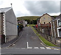
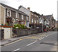
Convil Road, Blaengarw
Convil Road climbs from Nanthir Road towards James Road.
Image: © Jaggery Taken: 15 Aug 2014
0.01 miles
2
Cars parked off street in the setting sun
A group of cars parked in Blaengarw all face the glow of the evening sky as the sun sets beyond the Garw Forest. In awe?
Image: © Alan Hughes Taken: 13 Nov 2017
0.04 miles
3
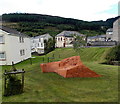
Small car park on sloping ground in Blaengarw
Located on the slope between the A4064 and the valley of a river, Afon Garw.
Image: © Jaggery Taken: 15 Aug 2014
0.05 miles
4
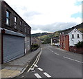
Nanthir Road, Blaengarw
Looking south along the A4064 Nanthir Road from the corner of Pretoria Street. http://www.geograph.org.uk/photo/4120859 There is no nameboard on the shuttered premises on the left.
Image: © Jaggery Taken: 15 Aug 2014
0.05 miles
5
Glen Garw, Blaengarw
Flats on the west side of the A4064 Nanthir Road.
Image: © Jaggery Taken: 15 Aug 2014
0.06 miles
6
Nanthir Lodge, Blaengarw
Flats viewed across the A4064 Nanthir Road.
Image: © Jaggery Taken: 15 Aug 2014
0.06 miles
7
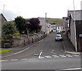
Pretoria Street, Blaengarw
Ascending from the A4064 Nanthir Road to James Road.
Image: © Jaggery Taken: 15 Aug 2014
0.07 miles
8
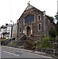
Dangerously derelict former Mount Zion Chapel in Blaengarw
The fenced-off former chapel on the east side of King Edward Street looked like it could collapse at any moment in this mid August 2014 view. The site is fenced off, and its looks like demolition work began but was abandoned at an early stage. This impression is reinforced by a notice on the wall showing ALL VISITORS & DRIVERS MUST REPORT TO SITE OFFICE. The chapel was built in 1905. Year of closure unknown.
Image: © Jaggery Taken: 15 Aug 2014
0.07 miles
9
King Edward Street, Blaengarw
Looking south along the A4064 King Edward Street towards a derelict former chapel. http://www.geograph.org.uk/photo/4120285
Image: © Jaggery Taken: 15 Aug 2014
0.07 miles
10
Mining Memorial in Blaengarw
Located on the west side of Nanthir Road, one of several memorials to miners and mining in the former mining village.
Image: © Jaggery Taken: 15 Aug 2014
0.08 miles
  • ...