1
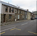
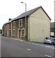
Row of houses, Ogwy Street, Nantymoel
Viewed across the A4061 looking towards Nantymoel Rugby Club clubhouse https://www.geograph.org.uk/photo/5888300 behind the cars.
Image: © Jaggery
Taken: 29 Aug 2018
0.02 miles
2
Nantymoel Rugby Club clubhouse
Clubhouse at 82-84 Ogwy Street in Nantymoel viewed across the A4061 on August 29th 2018.
Next fixture is at home against Birchgrove RFC kickoff 2:30pm on Saturday September 1st 2018.
Image: © Jaggery
Taken: 29 Aug 2018
0.02 miles
3
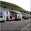
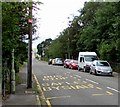
Terraced Houses at Lewistown
A row of terraced houses on the outskirts of Lewistown, Nantymoel, opposite the bus stop.
Image: © Alan Hughes
Taken: 18 May 2017
0.02 miles
4
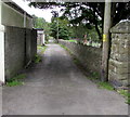
Lane past the eastern edge of Blaenogwr Cemetery in Nantymoel
Looking south from Park Street. The cemetery perimeter wall is on the right.
Image: © Jaggery
Taken: 29 Aug 2018
0.02 miles
5
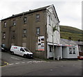
Novacraft Furniture store in Nantymoel
The building on the corner of Ogwy Street and Hill Street was originally Hope Independent Chapel built in 1898.
Image: © Jaggery
Taken: 29 Aug 2018
0.02 miles
6
Down Hill Street, Nantymoel
Hill Street descends towards the A4061 Ogwy Street.
Image: © Jaggery
Taken: 29 Aug 2018
0.03 miles
7
Ogwy Street houses in Nantymoel
On the east side of the A4061 Ogwy Street south of the Hill Street junction.
Image: © Jaggery
Taken: 29 Aug 2018
0.03 miles
8
Stone houses, Ogwy Street, Nantymoel
On the west side of the A4061 Ogwy Street. The car is on the corner of Park Street.
Image: © Jaggery
Taken: 29 Aug 2018
0.03 miles
9
Aber Road bus stop, Nantymoel
The shelterless stop alongside the A4061 Aber Road is for buses to Bridgend via Ogmore Vale, Blackmill and Sarn.
Image: © Jaggery
Taken: 29 Aug 2018
0.04 miles
10
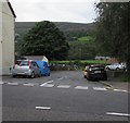
Junction of Ogwy Street and Park Street, Nantymoel
Viewed across the A4061 Ogwy Street looking along Park Street
towards the entrance gates https://www.geograph.org.uk/photo/5887910 to Blaenogwr Cemetery.
Image: © Jaggery
Taken: 29 Aug 2018
0.04 miles


