1
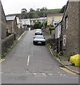
Steep ascent from Commercial Street, Nantymoel
A side road ascends towards Church Terrace.
Image: © Jaggery
Taken: 29 Aug 2018
0.04 miles
2
Nant-y-Moel Post Office
Post Office in Commercial Street, opposite the Nant-y-Moel Social Club and Institute.
Image: © Colin Pyle
Taken: 22 Aug 2008
0.04 miles
3
Bethel Chapel, Nantymoel
Another sign of the depressed condition of the Welsh valleys. The chapel, built in 1877, is steadily deteriorating despite plans 15 years ago to turn it into a residential care home.
Image: © Alan Hughes
Taken: 3 Sep 2023
0.04 miles
4
Derelict former Bethel Chapel, Commercial Street, Nantymoel
This is the 1872 rebuild of the original chapel erected in 1867.
The building and site appear long derelict in August 2018.
Image: © Jaggery
Taken: 29 Aug 2018
0.04 miles
5
Nantymoel Social Club, Commercial Street, Nantymoel
The longest of several names in view in August 2018 is
NANTYMOEL SOCIAL CLUB AND INSTITUTE 1929
Image: © Jaggery
Taken: 29 Aug 2018
0.04 miles
6
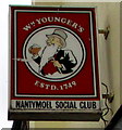
Nantymoel Social Club name sign, Nantymoel
On the wall on the left here. https://www.geograph.org.uk/photo/5892667
Image: © Jaggery
Taken: 29 Aug 2018
0.04 miles
7
Down Commercial Street, Nantymoel
Commercial Street descends past Nantymoel Social Club https://www.geograph.org.uk/photo/5892667
Image: © Jaggery
Taken: 29 Aug 2018
0.05 miles
8
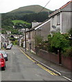
Up Commercial Street, Nantymoel
Commercial Street ascends to the southeast past a Londis convenience store https://www.geograph.org.uk/photo/5888777
Image: © Jaggery
Taken: 29 Aug 2018
0.06 miles
9
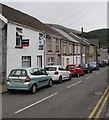
On-street parking, Commercial Street, Nantymoel
Parking allowed on the left. Double yellow lines on the right indicate no parking at any time.
Image: © Jaggery
Taken: 29 Aug 2018
0.06 miles
10
Formerly the Nantymoel Hotel
In its heyday a convenient hotel close to the railway station. Now, yet another sign of a run-down valleys community. A close look at the pub sign reveals the remaining letters of Welsh Brewers (above) and Nantymoel (below).
Image: © Alan Hughes
Taken: 3 Sep 2023
0.06 miles


