1
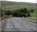
Towards a bend in the A4061, Nantymoel
Here named Bwlch-y-clawdd Road, the A4061 descends towards a bend at the Haul Bryn junction.
Image: © Jaggery
Taken: 29 Aug 2018
0.10 miles
2
Bungalows in Nantymoel
Above the north side of the A4061 Bwlch-y-clawdd Road.
Image: © Jaggery
Taken: 29 Aug 2018
0.10 miles
3
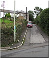
Osborne Terrace, Nantymoel
Ascending from the A4061 here named Bwlch-y-clawdd Road.
Image: © Jaggery
Taken: 29 Aug 2018
0.10 miles
4
Bridgend District : Grassy Field & Horse
A horse grazing in a grassy field in the Bridgend District.
Image: © Lewis Clarke
Taken: 23 Mar 2014
0.11 miles
5
Bridgend District : Grassy Field & Horse
Looking beyond the gate to a horse in the field.
Image: © Lewis Clarke
Taken: 23 Mar 2014
0.12 miles
6
Bridgend District : Countryside Scenery
Looking into a field where two horses are grazing.
Image: © Lewis Clarke
Taken: 23 Mar 2014
0.12 miles
7
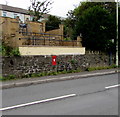
Wall postbox in Nantymoel
The box in the wall on the north side of the A4061 Bwlch-y-clawdd Road is from the reign of King George V. https://www.geograph.org.uk/photo/5894709
Image: © Jaggery
Taken: 29 Aug 2018
0.14 miles
8
King George V postbox, Bwlch-y-clawdd Road, Nantymoel
In the wall here. https://www.geograph.org.uk/photo/5894705
The GR on the box is short for Georgius Rex,
Latin for King George, in this case King George V
who reigned from May 1910-January 1936.
Image: © Jaggery
Taken: 29 Aug 2018
0.14 miles
9
Bridgend District : The A4061 & Countryside
A road heading down towards Prince Town.
Image: © Lewis Clarke
Taken: 23 Mar 2014
0.15 miles
10
Junction of the A4061 and Commercial Street, Nantymoel
From the A4061, Commercial Street on the left descends towards
the centre of the village. A small sign showing A4061 points right.
Image: © Jaggery
Taken: 29 Aug 2018
0.16 miles


