1
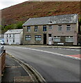
Ogmore Vale Convenience Store
At 21 Cemetery Road in Ogmore Vale, viewed across the A4061.
Image: © Jaggery
Taken: 14 Nov 2018
0.01 miles
2
Bend in the A4061, Ogmore Vale
The A4061 Bridge Street is behind the camera. Ahead on the A4061 Cemetery Road for Bridgend.
Image: © Jaggery
Taken: 14 Nov 2018
0.01 miles
3
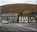
Houses and hillside, Ogmore Vale
Houses at the southern end of Walters Road viewed across the A4061 in November 2018.
Image: © Jaggery
Taken: 14 Nov 2018
0.02 miles
4
STOP on the approach to Bridge Street, Ogmore Vale
On a combined footpath/cycleway from Lewistown viewed in November 2018. Old maps show that the path uses a former railway route.
Image: © Jaggery
Taken: 14 Nov 2018
0.02 miles
5
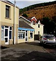
Elite Property estate agents office in Ogmore Vale
In November 2018 this is the only estate/letting agents based in Ogmore Vale.
Image: © Jaggery
Taken: 14 Nov 2018
0.02 miles
6
Welsh Water notice alongside a path, Ogmore Vale
Alongside a combined footpath/cycleway south of Bridge Street viewed in November 2018. The notice shows "To do the work safely, we'll need to temporarily close a section of the cycle track between Ogmore Vale and Lewistown." The text is also in Welsh. Old maps show a railway here.
Image: © Jaggery
Taken: 14 Nov 2018
0.02 miles
7
Standing at Caedu Box
Class 33, 33019 stands on the outskirts of Ogmore Vale with the Welsh Washery Wanderer railtour in September 1985. By this time Wyndham Colliery at the head of the valley had closed and Ogmore Vale Washery was awaiting its turn to be axed. By 1987 the crossing barriers here had been removed and the signal box was disused - it would subsequently be preserved on the Gwili Railway. Between the locomotive and the signal box, the service station and houses on Cemetery Road can be seen. From Google maps street view it looks like the service station is currently closed (2014).
Image: © Martin Addison
Taken: 28 Sep 1985
0.02 miles
8
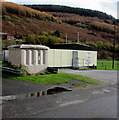
Water Street electricity substation, Ogmore Vale
Located 25 metres south of Water Street, the grey cabinet is a Western Power Distribution electricity substation. Its identifier is WATER STREET OGMORE VALE S/S 563719.
Image: © Jaggery
Taken: 14 Nov 2018
0.02 miles
9
Cemetery Road approaching Ogmore Vale
Image: © Colin Pyle
Taken: 15 Jul 2012
0.02 miles
10
Daisy Chains Florist, Ogmore Vale
At 2 Walters Road, one mile from Wyndham.
Image: © Jaggery
Taken: 14 Nov 2018
0.02 miles


