IMAGES TAKEN NEAR TO
Hendre Avenue, BRIDGEND, CF32 7HD

Introduction

This page details the photographs taken nearby to Hendre Avenue, CF32 7HD by members of the Geograph project.

The Geograph project started in 2005 with the aim of publishing, organising and preserving representative images for every square kilometre of Great Britain, Ireland and the Isle of Man.

There are currently over 7.5m images from over14,400 individuals and you can help contribute to the project by visiting https://www.geograph.org.uk

Image Map


Images are licensed for reuse under creativecommons.org/licenses/by-sa/2.0
Notes
  • Clicking on the map will re-center to the selected point.
  • The higher the marker number, the further away the image location is from the centre of the postcode.

Image Listing (79 Images Found)

Images are licensed for reuse under creativecommons.org/licenses/by-sa/2.0
  • ...
Image
Details
Distance
1
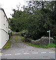
Unnamed road from Nantymoel to Wyndham
Looking west from Aber Road in Nantymoel.
Image: © Jaggery Taken: 4 Oct 2018
0.02 miles
2
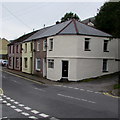
Row of houses at the northern edge of Wyndham
On the west side of Wyndham Street opposite the village pub. https://www.geograph.org.uk/photo/5929211
Image: © Jaggery Taken: 4 Oct 2018
0.05 miles
3
Wyndham From Cwm Ogwr Fawr
Chapel visible centre left of photo
Image: © Bonelli Taken: Unknown
0.05 miles
4
Public footpath ascending from Wyndham Street, Wyndham
The path is on a bank of an apparently unnamed stream, a tributary of the Ogwr Fawr river.
Image: © Jaggery Taken: 4 Oct 2018
0.05 miles
5
Short row of houses, Wyndham Street, Wyndham
At the northern edge of the village, opposite the Wyndham pub.
Image: © Jaggery Taken: 4 Oct 2018
0.06 miles
6
Ordnance Survey Cut Mark
This OS cut mark can be found on the wall of No47 Wyndham Street. It marks a point 172.255m above mean sea level.
Image: © Adrian Dust Taken: 29 May 2017
0.06 miles
7
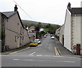
West side of Dunraven Place, Wyndham
Row of houses extending to the corner of Fairy Glen https://www.geograph.org.uk/photo/5929126 and the southern end of Wyndham Street.
Image: © Jaggery Taken: 4 Oct 2018
0.06 miles
8
Fairy Glen, Wyndham
The road named Fairy Glen ascends from the west side of Wyndham Street.
Image: © Jaggery Taken: 4 Oct 2018
0.06 miles
9
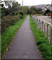
South along a combined footpath and cycleway, Wyndham
The former railway route is part of National Cycle Network Route 883 from Nantymoel to Blackmill. Ahead for Ogmore Vale and Blackmill.
Image: © Jaggery Taken: 4 Oct 2018
0.06 miles
10
Wyndham Public House, Wyndham Street, Wyndham
Image: © Colin Pyle Taken: 15 Jul 2012
0.06 miles
  • ...