1
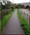
Unnamed road from Nantymoel to Wyndham
Looking west from Aber Road in Nantymoel.
Image: © Jaggery
Taken: 4 Oct 2018
0.02 miles
2
South along a combined footpath and cycleway, Wyndham
The former railway route is part of National Cycle Network Route 883
from Nantymoel to Blackmill. Ahead for Ogmore Vale and Blackmill.
Image: © Jaggery
Taken: 4 Oct 2018
0.03 miles
3
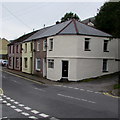
Row of houses at the northern edge of Wyndham
On the west side of Wyndham Street opposite the village pub. https://www.geograph.org.uk/photo/5929211
Image: © Jaggery
Taken: 4 Oct 2018
0.03 miles
4
Cycle route 883 from Wyndham towards Nantymoel
In 2018 this footpath and cycleway is part of National Cycle Network Route 883, a 7km (4 miles) long route on a former railway trackbed from Blackmill to Nantymoel via Ogmore Vale. The remains of the former Wyndham Halt station https://www.geograph.org.uk/photo/5930541 are behind the camera.
Image: © Jaggery
Taken: 4 Oct 2018
0.04 miles
5
The Wyndham, Wyndham Street, Wyndham
The Wyndham (or the Wyndham Arms) pub is at the northern edge of the village.
https://www.geograph.org.uk/photo/5929219 to the name sign
Image: © Jaggery
Taken: 4 Oct 2018
0.05 miles
6
Wyndham Public House, Wyndham Street, Wyndham
Image: © Colin Pyle
Taken: 15 Jul 2012
0.05 miles
7
Ordnance Survey Cut Mark
This OS cut mark can be found on the wall of No47 Wyndham Street. It marks a point 172.255m above mean sea level.
Image: © Adrian Dust
Taken: 29 May 2017
0.05 miles
8
Short row of houses, Wyndham Street, Wyndham
At the northern edge of the village, opposite the Wyndham pub.
Image: © Jaggery
Taken: 4 Oct 2018
0.05 miles
9
The Wyndham pub name sign, Wyndham Street, Wyndham
Hanging from a wall bracket here. https://www.geograph.org.uk/photo/5929211
Image: © Jaggery
Taken: 4 Oct 2018
0.05 miles
10
North side of the Wyndham Arms, Wyndham
The name on this side of the pub is the Wyndham Arms.
The name on the east side is the Wyndham. https://www.geograph.org.uk/photo/5929211
Image: © Jaggery
Taken: 4 Oct 2018
0.05 miles


