IMAGES TAKEN NEAR TO
Bryn Road, BRIDGEND, CF32 7DW

Introduction

This page details the photographs taken nearby to Bryn Road, CF32 7DW by members of the Geograph project.

The Geograph project started in 2005 with the aim of publishing, organising and preserving representative images for every square kilometre of Great Britain, Ireland and the Isle of Man.

There are currently over 7.5m images from over14,400 individuals and you can help contribute to the project by visiting https://www.geograph.org.uk

Image Map


Images are licensed for reuse under creativecommons.org/licenses/by-sa/2.0
Notes
  • Clicking on the map will re-center to the selected point.
  • The higher the marker number, the further away the image location is from the centre of the postcode.

Image Listing (107 Images Found)

Images are licensed for reuse under creativecommons.org/licenses/by-sa/2.0
  • ...
Image
Details
Distance
1
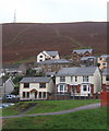
Houses in Ogmore Vale with hillside behind
Looking across Park Avenue with Bryn Road behind.
Image: © Andrew Hill Taken: 20 Oct 2008
0.02 miles
2
Recreation ground in Ogmore Vale
Looking at an angle across and up the main valley.
Image: © Andrew Hill Taken: 20 Oct 2008
0.07 miles
3
Terraced street, Ogmore Vale
Mynydd Llangeinwyr rising beyond.
Image: © Andrew Hill Taken: 20 Oct 2008
0.08 miles
4
Up Park Avenue, Ogmore Vale
From Walters Road, Park Avenue ascends towards Meadow Street. The houses here are all on the west side of the road.
Image: © Jaggery Taken: 25 Aug 2018
0.08 miles
5
In Ogmore Vale
View from a well laid footpath along the line of the former railway.
Image: © Andrew Hill Taken: 20 Oct 2008
0.08 miles
6
Ogmore Vale Bowls Club name sign and badge
On the wall here. https://www.geograph.org.uk/photo/6194125
Image: © Jaggery Taken: 25 Aug 2018
0.09 miles
7
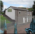
Ogmore Vale Bowls Club pavilion
The pavilion is between lawn tennis courts to the south and a bowling green to the north.
Image: © Jaggery Taken: 25 Aug 2018
0.09 miles
8
Park Avenue houses, Ogmore Vale
The houses here are all on the west side of the road.
Image: © Jaggery Taken: 25 Aug 2018
0.09 miles
9
Down Park Avenue, Ogmore Vale
Park Avenue descends towards Walters Road and Bridge Street.
Image: © Jaggery Taken: 25 Aug 2018
0.09 miles
10
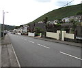
Walters Road, Ogmore Vale
Looking to the NNW along unclassified Walters Road from the corner of the A4061. The corner shop at 2 Walters Road on the right is Daisy Chains Florist. https://www.geograph.org.uk/photo/5974797
Image: © Jaggery Taken: 14 Nov 2018
0.09 miles
  • ...