1
Bend in Prospect Place, Ogmore Vale
Viewed from the northern end of Meadow Street.
Image: © Jaggery
Taken: 25 Aug 2018
0.01 miles
2
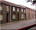
West side of Prospect Place, Ogmore Vale
Row of houses extending towards School Road.
Image: © Jaggery
Taken: 25 Aug 2018
0.02 miles
3
Ogmore Vale
The Welsh valley town of Ogmore Vale, an old mining community.
Image: © Alan Hughes
Taken: 20 Oct 2020
0.03 miles
4
House on the corner of School Road and Llywelyn Street, Ogmore Vale
The car is in School Road.
Image: © Jaggery
Taken: 25 Aug 2018
0.04 miles
5
Postbox in a Llywelyn Street wall, Ogmore Vale
The box is from the reign of King George V. https://www.geograph.org.uk/photo/5886478
Image: © Jaggery
Taken: 25 Aug 2018
0.04 miles
6
King George V postbox in a Llywelyn Street wall, Ogmore Vale
Located here. https://www.geograph.org.uk/photo/5886477 The GR on the box is short for Georgius Rex, Latin for King George,
in this case King George V who reigned from May 1910-January 1936.
Image: © Jaggery
Taken: 25 Aug 2018
0.04 miles
7
School Road, Ogmore Vale
Ascending from Prospect Place towards Highland Place.
Image: © Jaggery
Taken: 25 Aug 2018
0.04 miles
8
Detached house in Ogmore Vale
On the west side of Llywelyn Street.
Image: © Jaggery
Taken: 25 Aug 2018
0.05 miles
9
Old-style name sign, Meadow Street, Ogmore Vale
A white on dark blue enamel sign is on the house at the northern end of Meadow Street on the corner of Oak Terrace.
Image: © Jaggery
Taken: 25 Aug 2018
0.05 miles
10
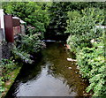
Downstream along the Ogwr Fawr, Ogmore Vale
Viewed from this https://www.geograph.org.uk/photo/6074596 footbridge. The Ogwr Fawr flows towards its confluence with the Ogwr Fach at Blackmill about 4 km away. Beyond the confluence the river is the Ogmore (Afon Ogwr in Welsh).
Image: © Jaggery
Taken: 25 Aug 2018
0.05 miles


